File:Tulketh ward locator map.svg
Jump to navigation
Jump to search

Size of this PNG preview of this SVG file: 545 × 599 pixels. Other resolutions: 218 × 240 pixels | 437 × 480 pixels | 699 × 768 pixels | 931 × 1,024 pixels | 1,863 × 2,048 pixels | 1,187 × 1,305 pixels.
Original file (SVG file, nominally 1,187 × 1,305 pixels, file size: 323 KB)
Summary
| Description |
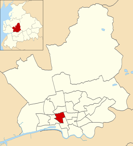
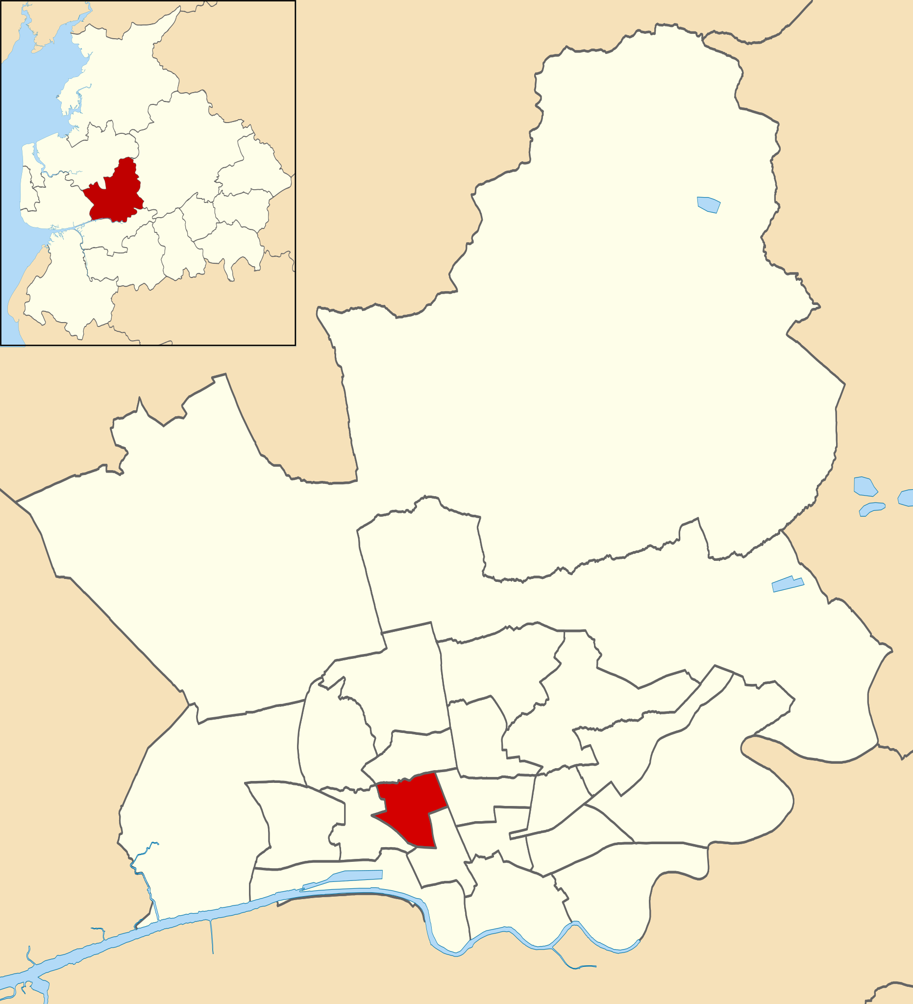
English: Locator map of Tulketh electoral ward within the City of Preston district, Lancashire, England. |
| Date | |
| Source |
This file was derived from: Preston UK ward map 2010 (blank).svg: |
| Author |
.svg)
Licensing
This file is licensed under the Creative Commons Attribution-Share Alike 4.0 International license.
Attribution: Nilfanion and Dr Greg. Contains Ordnance Survey data © Crown copyright and database right 2010.
- You are free:
- to share – to copy, distribute and transmit the work
- to remix – to adapt the work
- Under the following conditions:
- attribution – You must give appropriate credit, provide a link to the license, and indicate if changes were made. You may do so in any reasonable manner, but not in any way that suggests the licensor endorses you or your use.
- share alike – If you remix, transform, or build upon the material, you must distribute your contributions under the same or compatible license as the original.
File history
Click on a date/time to view the file as it appeared at that time.
| Date/Time | Thumbnail | Dimensions | User | Comment | |
|---|---|---|---|---|---|
| current | 15:42, 8 April 2018 | | 1,187 × 1,305 (323 KB) | commons>Dr Greg | User created page with UploadWizard |
File usage
There are no pages that use this file.