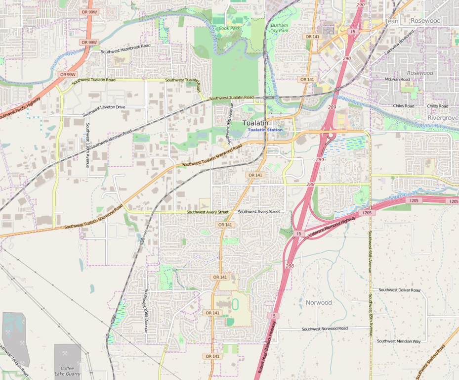
File:Tualatin OR - OpenStreetMap.png
Jump to navigation
Jump to search

Size of this preview: 725 × 600 pixels. Other resolutions: 290 × 240 pixels | 581 × 480 pixels | 929 × 768 pixels | 1,029 × 851 pixels.
Original file (1,029 × 851 pixels, file size: 759 KB, MIME type: image/png)
File history
Click on a date/time to view the file as it appeared at that time.
| Date/Time | Thumbnail | Dimensions | User | Comment | |
|---|---|---|---|---|---|
| current | 23:06, 14 April 2016 | | 1,029 × 851 (759 KB) | commons>Tagishsimon | {{OpenStreetMap | name = Tualatin_OR | location = Tualatin_OR | description = Map of Tualatin Oregon. | top = 45.4007 | bottom = 45.3486 | left = -122.8162 | right = -122.7266 | date =... |
File usage
There are no pages that use this file.