File:Trianon map it.PNG
Jump to navigation
Jump to search
No higher resolution available.
Trianon_map_it.PNG (655 × 500 pixels, file size: 52 KB, MIME type: image/png)
File history
Click on a date/time to view the file as it appeared at that time.
| Date/Time | Thumbnail | Dimensions | User | Comment | |
|---|---|---|---|---|---|
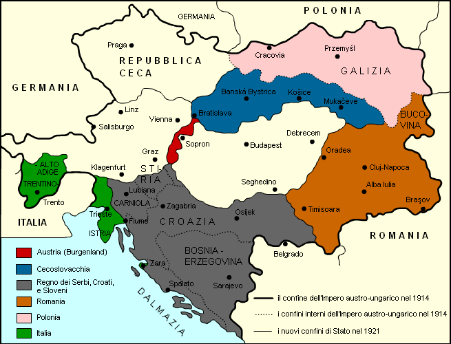
| current | 18:44, 29 February 2012 | | 655 × 500 (52 KB) | commons>Harlock81 | == {{int:filedesc}} == {{Information |Description=== {{it|Variazioni nei confini dell'Impero austro-ungarico dopo il Trattato del Trianon del 1920.}} |Source={{Derived from|Trianon_map_hu.png|display=50}} |Date=2012-02-29 1... |
File usage
There are no pages that use this file.