File:Topomap Osterholzer Geest.svg
Jump to navigation
Jump to search

Size of this PNG preview of this SVG file: 500 × 515 pixels. Other resolutions: 233 × 240 pixels | 466 × 480 pixels | 746 × 768 pixels | 994 × 1,024 pixels | 1,988 × 2,048 pixels.
Original file (SVG file, nominally 500 × 515 pixels, file size: 1.34 MB)
File history
Click on a date/time to view the file as it appeared at that time.
| Date/Time | Thumbnail | Dimensions | User | Comment | |
|---|---|---|---|---|---|
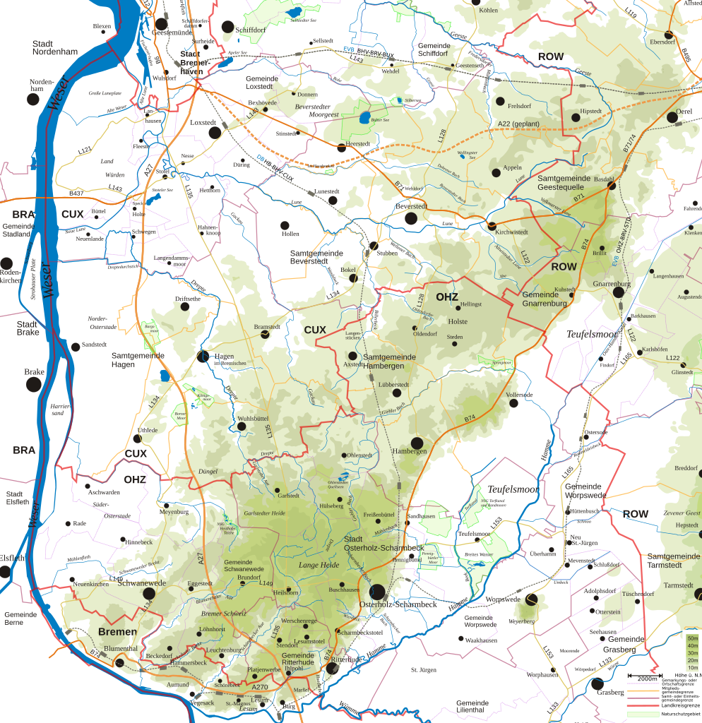
| current | 21:59, 12 August 2009 | | 500 × 515 (1.34 MB) | commons>CWitte | {{Information |Description={{en|1=Topographic map of the ''geestland'' region "Osterholzer Geest", north of Bremen}} {{de|1=Topografische Karte der Osterholzer Geest im Elbe-Weser-Dreieck nördlich von Bremen}} |Source=Eigenes Werk (own work) |Author=[[Us |
File usage
There are no pages that use this file.