File:Topographic map of Ukraine (with borders and towns).svg
Jump to navigation
Jump to search

Size of this PNG preview of this SVG file: 800 × 529 pixels. Other resolutions: 320 × 212 pixels | 640 × 424 pixels | 1,024 × 678 pixels | 1,280 × 847 pixels | 2,560 × 1,694 pixels | 1,449 × 959 pixels.
Original file (SVG file, nominally 1,449 × 959 pixels, file size: 7.28 MB)
.svg)
Summary
| Description |
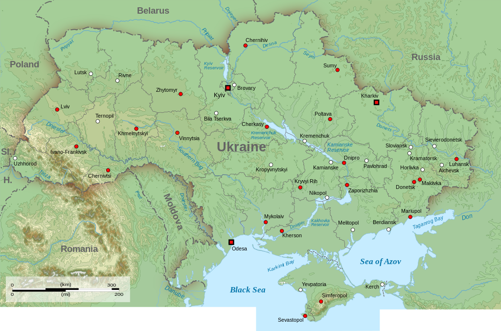
English: Topographic map of Ukraine (with borders and towns)
Sl.: Slovakia H.: Hungary |
| Date | |
| Source | Own work |
| Author | Amitchell125 (File:Topographic_map_of_Ukraine.svg with borders and towns added using https://commons.wikimedia.org/wiki/File:Map_of_Ukraine_with_Cities.png) |
| Permission (Reusing this file) |
I, the copyright holder of this work, hereby publish it under the following license: This file is licensed under the Creative Commons Attribution-Share Alike 4.0 International license.
|
| Annotations | This image is annotated: View the annotations at Commons |
- ↑ https://www.nbcnews.com/storyline/ukraine-crisis/beyond-crimea-places-russia-experts-say-you-should-watch-next-n57691 Beyond Crimea: The Places Russia Experts Say You Should Watch Next
- ↑ https://www.nbcnews.com/storyline/ukraine-crisis/beyond-crimea-places-russia-experts-say-you-should-watch-next-n57691 Beyond Crimea: The Places Russia Experts Say You Should Watch Next
File history
Click on a date/time to view the file as it appeared at that time.
| Date/Time | Thumbnail | Dimensions | User | Comment | |
|---|---|---|---|---|---|
| current | 17:28, 3 April 2024 | | 1,449 × 959 (7.28 MB) | commons>Vanyka-slovanyka | File uploaded using svgtranslate tool (https://svgtranslate.toolforge.org/). Added translation for ru. |
File usage
There are no pages that use this file.
.svg)