File:Topo map AZ AM en.png
Jump to navigation
Jump to search

Size of this preview: 800 × 497 pixels. Other resolutions: 320 × 199 pixels | 640 × 398 pixels | 1,024 × 636 pixels | 1,280 × 795 pixels | 2,560 × 1,590 pixels | 5,660 × 3,516 pixels.
Original file (5,660 × 3,516 pixels, file size: 21.11 MB, MIME type: image/png)
File history
Click on a date/time to view the file as it appeared at that time.
| Date/Time | Thumbnail | Dimensions | User | Comment | |
|---|---|---|---|---|---|
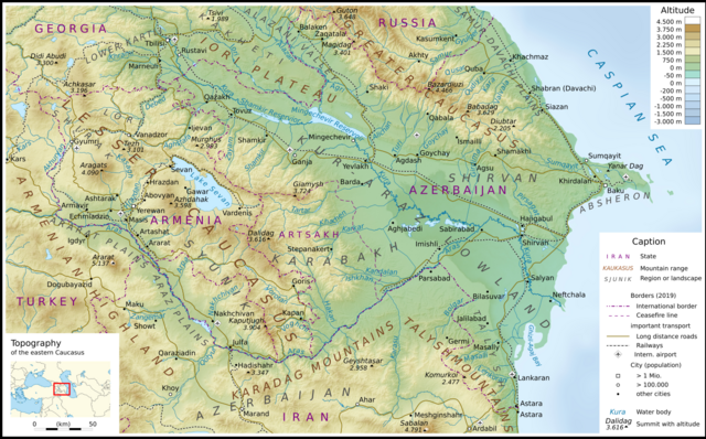
| current | 15:01, 1 November 2020 | | 5,660 × 3,516 (21.11 MB) | commons>Don-kun | {{Information |Description=Topographic map of Armenia and Azerbaijan. Toponyms chosen according to articles in the English language Wikipedia. |Source={{own}}; Topographischer Hintergrund: [http://www2.jpl.nasa.gov/srtm NASA Shuttle Radar Topography Mission] (public domain). SRTM3 v.2.<br /> Grenzen: Armenia adm location map.svg, Azerbaijan adm location map.svg;<br /> Gewässer: OpenStreetMap |Date=2020-11-01 |Aut... |
File usage
There are no pages that use this file.