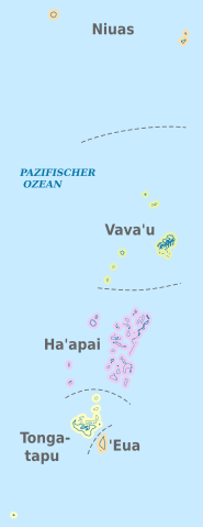
File:Tonga, administrative divisions - de - colored.svg
Jump to navigation
Jump to search

Size of this PNG preview of this SVG file: 231 × 598 pixels. Other resolutions: 92 × 240 pixels | 185 × 480 pixels | 296 × 768 pixels | 395 × 1,024 pixels | 791 × 2,048 pixels | 677 × 1,753 pixels.
Original file (SVG file, nominally 677 × 1,753 pixels, file size: 219 KB)
File history
Click on a date/time to view the file as it appeared at that time.
| Date/Time | Thumbnail | Dimensions | User | Comment | |
|---|---|---|---|---|---|
| current | 15:52, 6 November 2012 | 677 × 1,753 (219 KB) | commons>TUBS | == {{int:filedesc}} == {{Information |Description={{de|Karte der politischen Gliederung von XY (siehe Dateiname)}} {{en|Map of administrative divisions of XY (see filename)}} |Source={{own}}{{Adobe Illustrator}}{{Commonist}}{{AttribSVG|Haapai_in_Tonga... |
File usage
There are no pages that use this file.