File:Thunder Bay NMS map.jpg
Jump to navigation
Jump to search
Size of this preview: 464 × 599 pixels. Other resolutions: 186 × 240 pixels | 372 × 480 pixels | 595 × 768 pixels | 793 × 1,024 pixels | 1,549 × 2,000 pixels.
Original file (1,549 × 2,000 pixels, file size: 442 KB, MIME type: image/jpeg)
File history
Click on a date/time to view the file as it appeared at that time.
| Date/Time | Thumbnail | Dimensions | User | Comment | |
|---|---|---|---|---|---|
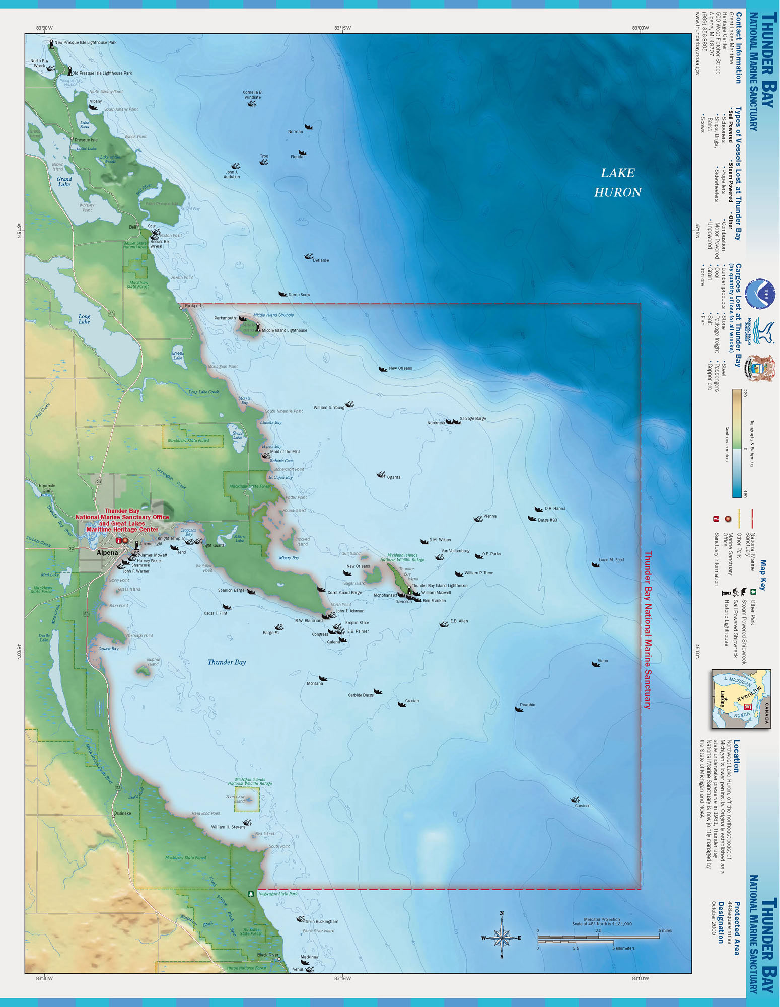
| current | 01:42, 17 October 2006 | | 1,549 × 2,000 (442 KB) | commons>Davepape | {{Information |Description=Map of the Thunder Bay National Marine Sanctuary |Source=http://www.sanctuaries.noaa.gov/pgallery/atlasmaps/tb.html |Date= |Author=NOAA, National Marine Sanctuaries |Permission=PD |o |
File usage
There are no pages that use this file.