File:The division of Europe by cardinal directions.Center of Europe near Vilnius. Caucasus border.png
Jump to navigation
Jump to search

Size of this preview: 573 × 599 pixels. Other resolutions: 230 × 240 pixels | 459 × 480 pixels | 735 × 768 pixels | 979 × 1,024 pixels | 2,200 × 2,300 pixels.
Original file (2,200 × 2,300 pixels, file size: 253 KB, MIME type: image/png)
File history
Click on a date/time to view the file as it appeared at that time.
| Date/Time | Thumbnail | Dimensions | User | Comment | |
|---|---|---|---|---|---|
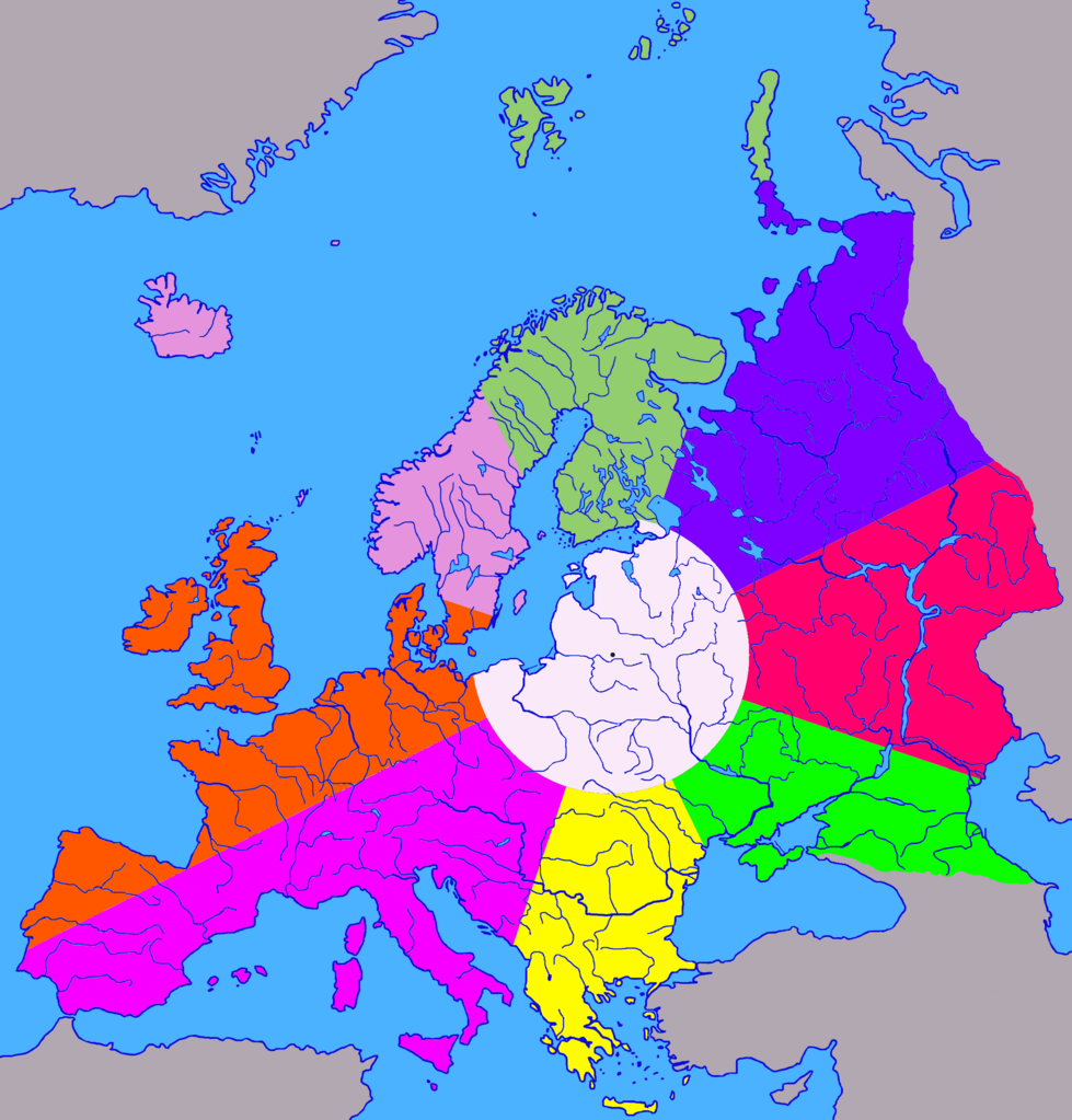
| current | 18:05, 7 August 2023 | | 2,200 × 2,300 (253 KB) | commons>Germash19 | == {{int:filedesc}} == {{Information |Description={{en|1=The division of Europe from the geographical center (near Vilnius) into 8 cardinal directions and the central part. The land area of the central part is 1/9 of the area of Europe, radius 680 km.}} {{ru|1=Деление Европы из географического центра возле Вильнюса на 8 сторон света и центральную часть. Площадь центральной части по суше составляет 1/9 от площади Европы, радиус 680 км.}} |Source={{own}} |Date=2023 |Author=Germash19 |Permission... |
File usage
There are no pages that use this file.