File:The Slave Coast on a John Bartholomew & Co. map published c. 1914 (part).jpg
Original file (1,541 × 946 pixels, file size: 780 KB, MIME type: image/jpeg)
.jpg)
| Description |
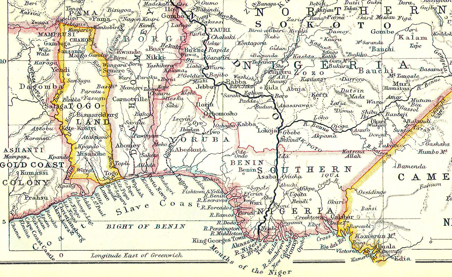
English: The Slave Coast on a John Bartholomew & Co. map published c. 1914 (part). |
||||
| Date | circa 1914 | ||||
| Source | Scan of original | ||||
| Author | John Bartholomew & Co. Edinburgh | ||||
| Permission (Reusing this file) |
|
||||
File history
Click on a date/time to view the file as it appeared at that time.
| Date/Time | Thumbnail | Dimensions | User | Comment | |
|---|---|---|---|---|---|
| current | 23:20, 30 October 2013 | | 1,541 × 946 (780 KB) | commons>Philafrenzy | {{Information |Description ={{en|1=The Slave Coast on a John Bartholomew & Co. map published c. 1914 (part).}} |Source =Scan of original |Author =John Bartholomew & Co. Edinburgh |Date =c. 1914 |Permission ={{PD-Old}} |... |
File usage
There are no pages that use this file.
.jpg)