File:Tectonic plates boundaries World map Wt 180degE centered-en.svg
Jump to navigation
Jump to search

Size of this PNG preview of this SVG file: 800 × 489 pixels. Other resolutions: 320 × 196 pixels | 640 × 391 pixels | 1,024 × 626 pixels | 1,280 × 782 pixels | 2,560 × 1,564 pixels | 4,903 × 2,996 pixels.
Original file (SVG file, nominally 4,903 × 2,996 pixels, file size: 4.86 MB)
File history
Click on a date/time to view the file as it appeared at that time.
| Date/Time | Thumbnail | Dimensions | User | Comment | |
|---|---|---|---|---|---|
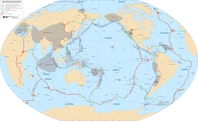
| current | 20:38, 16 February 2018 | | 4,903 × 2,996 (4.86 MB) | commons>Sting | {{Information |Description={{en|World map in English showing the tectonic plates boundaries with their movement vectors and selected hotspots.}} {{fr|Carte mondiale en anglais des limites des plaques tectoniques avec leurs vecteurs de déplacement et u... |
File usage
There are no pages that use this file.