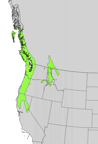
File:Taxus brevifolia range map.png
Jump to navigation
Jump to search

Size of this preview: 409 × 599 pixels. Other resolutions: 164 × 240 pixels | 328 × 480 pixels | 524 × 768 pixels | 1,042 × 1,526 pixels.
Original file (1,042 × 1,526 pixels, file size: 193 KB, MIME type: image/png)
File history
Click on a date/time to view the file as it appeared at that time.
| Date/Time | Thumbnail | Dimensions | User | Comment | |
|---|---|---|---|---|---|
| current | 15:37, 11 October 2012 | | 1,042 × 1,526 (193 KB) | commons>Pinethicket | {{Information |Description ={{en|1=Range map of ''Taxus brevifolia'' }} |Source =Digital representation of "Atlas of United States Trees" by Elbert L. Little, Jr. [http://esp.cr.usgs.gov/data/atlas/little/] |Author =U.S. Geological S... |
File usage
There are no pages that use this file.