File:Taongi Atoll - EVS Precision Map (1-110,000).jpg
Jump to navigation
Jump to search

Size of this preview: 800 × 558 pixels. Other resolutions: 320 × 223 pixels | 640 × 446 pixels | 1,024 × 714 pixels | 1,258 × 877 pixels.
Original file (1,258 × 877 pixels, file size: 201 KB, MIME type: image/jpeg)
.jpg)
File history
Click on a date/time to view the file as it appeared at that time.
| Date/Time | Thumbnail | Dimensions | User | Comment | |
|---|---|---|---|---|---|
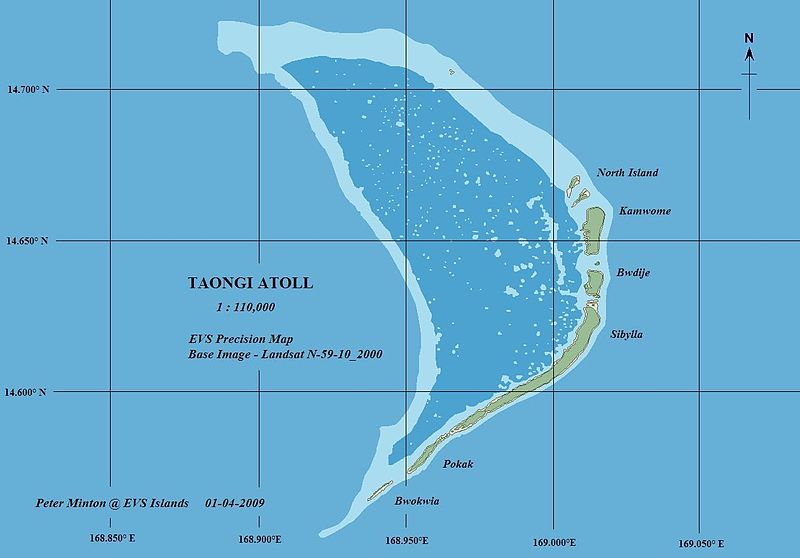
| current | 02:03, 21 March 2009 | | 1,258 × 877 (201 KB) | commons>Cmholm | {{Information |Description= Taongi (Bokak) Atoll EVS precision map |Source=[http://www.flickr.com/photos/60042877@N00/3166428015/ Taongi Atoll - EVS Precision Map (1-110,000)] |Date=January 04, 2009 at 08:27 |Author=[http://www.flickr.com/people/60042877@ |
File usage
There are no pages that use this file.
.jpg)