File:TAAF-fr.png
Jump to navigation
Jump to search
No higher resolution available.
TAAF-fr.png (786 × 447 pixels, file size: 102 KB, MIME type: image/png)
File history
Click on a date/time to view the file as it appeared at that time.
| Date/Time | Thumbnail | Dimensions | User | Comment | |
|---|---|---|---|---|---|
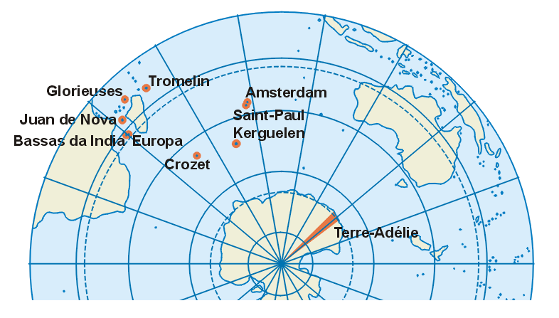
| current | 18:38, 4 February 2007 | | 786 × 447 (102 KB) | commons>Aotearoa | Carte des Terres australes et antarctiques françaises<br> Map of French Southern and Antarctic Lands in French |
File usage
There are no pages that use this file.