File:Sus scrofa range map.jpg
Jump to navigation
Jump to search
Size of this preview: 800 × 397 pixels. Other resolutions: 320 × 159 pixels | 640 × 318 pixels | 1,280 × 635 pixels.
Original file (1,280 × 635 pixels, file size: 270 KB, MIME type: image/jpeg)

|
This map image could be re-created using vector graphics as an SVG file. This has several advantages; see Commons:Media for cleanup for more information. If an SVG form of this image is available, please upload it and afterwards replace this template with
{{vector version available|new image name}}.
It is recommended to name the SVG file “Sus scrofa range map.svg”—then the template Vector version available (or Vva) does not need the new image name parameter. |


Summary
| Description |
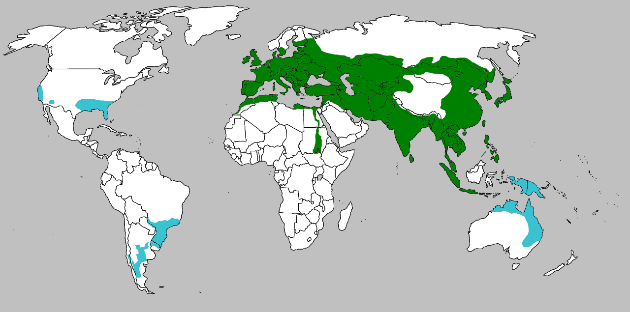
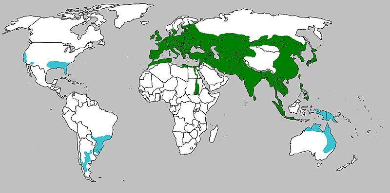
English: Reconstructed range (green) and introduced (teal) Sus scrofa
Français : Aire de répartition naturelle (en vert) et d'introduction (en bleu) du sanglier Sus scrofa |
| Date | |
| Source | Own work |
| Author | Altaileopard |
Licensing
| I, the copyright holder of this work, release this work into the public domain. This applies worldwide. In some countries this may not be legally possible; if so: I grant anyone the right to use this work for any purpose, without any conditions, unless such conditions are required by law. |
File history
Click on a date/time to view the file as it appeared at that time.
| Date/Time | Thumbnail | Dimensions | User | Comment | |
|---|---|---|---|---|---|
| current | 08:47, 23 October 2021 | | 1,280 × 635 (270 KB) | commons>MPF | clearer distinction between green & blue |
File usage
There are no pages that use this file.