File:Suriname districts named.png
Jump to navigation
Jump to search
Size of this preview: 585 × 599 pixels. Other resolutions: 234 × 240 pixels | 469 × 480 pixels | 750 × 768 pixels.
Original file (750 × 768 pixels, file size: 23 KB, MIME type: image/png)
File history
Click on a date/time to view the file as it appeared at that time.
| Date/Time | Thumbnail | Dimensions | User | Comment | |
|---|---|---|---|---|---|
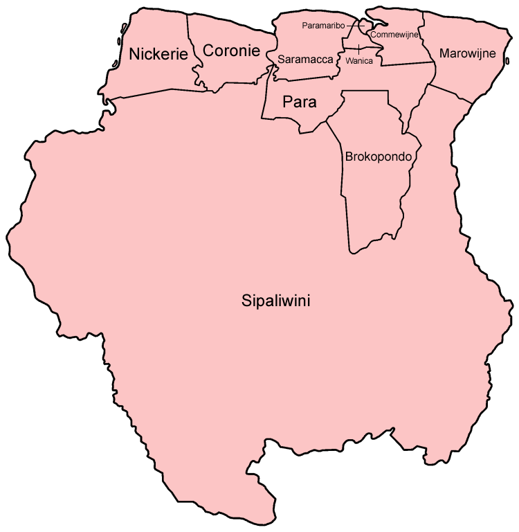
| current | 21:15, 2 January 2006 | | 750 × 768 (23 KB) | commons>Golbez | Map of the districts of Suriname in Dutch (local language). Made by User:Golbez. Category:Maps of Suriname |
File usage
There are no pages that use this file.