File:SurfaceConvexityMtRainier.jpg
Jump to navigation
Jump to search
No higher resolution available.
SurfaceConvexityMtRainier.jpg (800 × 500 pixels, file size: 72 KB, MIME type: image/jpeg)
File history
Click on a date/time to view the file as it appeared at that time.
| Date/Time | Thumbnail | Dimensions | User | Comment | |
|---|---|---|---|---|---|
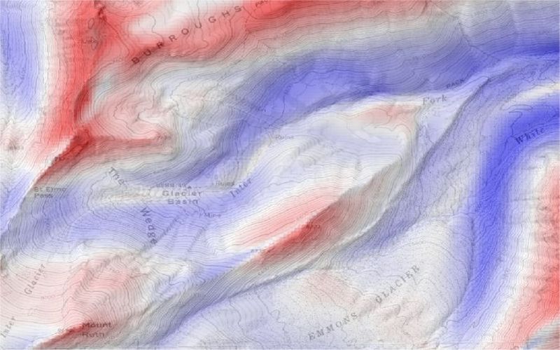
| current | 11:43, 14 May 2005 | | 800 × 500 (72 KB) | commons>Jwo | Surface curvature, convex-up in blue, concave-up in red derived from USGS 30m DEM of Mount Rainier, Washington. These curvature values calculated in LandSerf using a large kernel size to produce regional curvature measures. The results are blended in |
File usage
There are no pages that use this file.