File:Sumatra 2007 earthquakes map.gif
Jump to navigation
Jump to search
No higher resolution available.
Sumatra_2007_earthquakes_map.gif (505 × 496 pixels, file size: 30 KB, MIME type: image/gif)
File history
Click on a date/time to view the file as it appeared at that time.
| Date/Time | Thumbnail | Dimensions | User | Comment | |
|---|---|---|---|---|---|
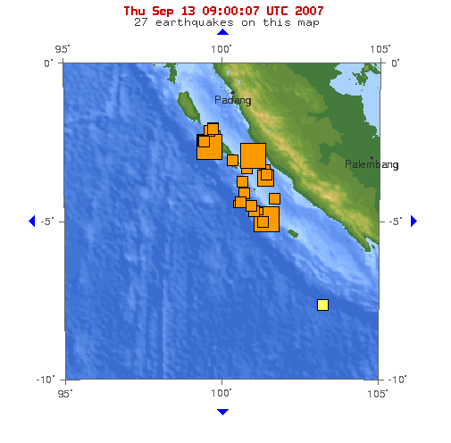
| current | 09:53, 13 September 2007 | | 505 × 496 (30 KB) | commons>TheDJ | == Summary == '''Image:''' This map shows the location of the 3 major earthquakes and it's many aftershocks off the coast of Sumatra on September 12 and September 13, 2007. It shows a total of 27 earthquakes, 25 of them in the last 24 hours. |
File usage
There are no pages that use this file.