File:StateLibQld 1 293719 Aerial view of Annerley, Brisbane, ca. 1934.jpg
Jump to navigation
Jump to search

Size of this preview: 800 × 599 pixels. Other resolutions: 320 × 240 pixels | 640 × 479 pixels | 1,000 × 749 pixels.
Original file (1,000 × 749 pixels, file size: 101 KB, MIME type: image/jpeg)
File history
Click on a date/time to view the file as it appeared at that time.
| Date/Time | Thumbnail | Dimensions | User | Comment | |
|---|---|---|---|---|---|
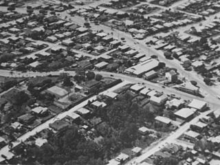
| current | 22:20, 10 January 2011 | | 1,000 × 749 (101 KB) | commons>SLQbot | =={{int:filedesc}}== {{Information |description={{en|1=Aerial view of Annerley, Brisbane, ca. 1934. Ipswich Road is in the centre from left to right with Cronin Street and Fanny Street running up to it. Junction Hotel is at the intersection. 26-28 Cronin |
File usage
There are no pages that use this file.