File:Stanford Map, 1901, Outer London Map.jpg
Jump to navigation
Jump to search

Size of this preview: 799 × 600 pixels. Other resolutions: 320 × 240 pixels | 640 × 480 pixels | 1,024 × 768 pixels | 1,280 × 961 pixels | 2,560 × 1,921 pixels | 10,035 × 7,531 pixels.
Original file (10,035 × 7,531 pixels, file size: 84.03 MB, MIME type: image/jpeg)
Summary
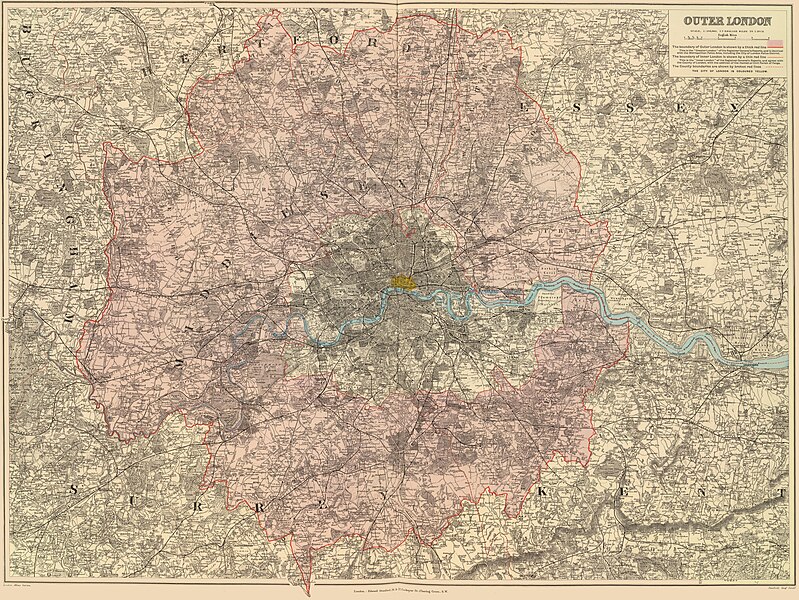
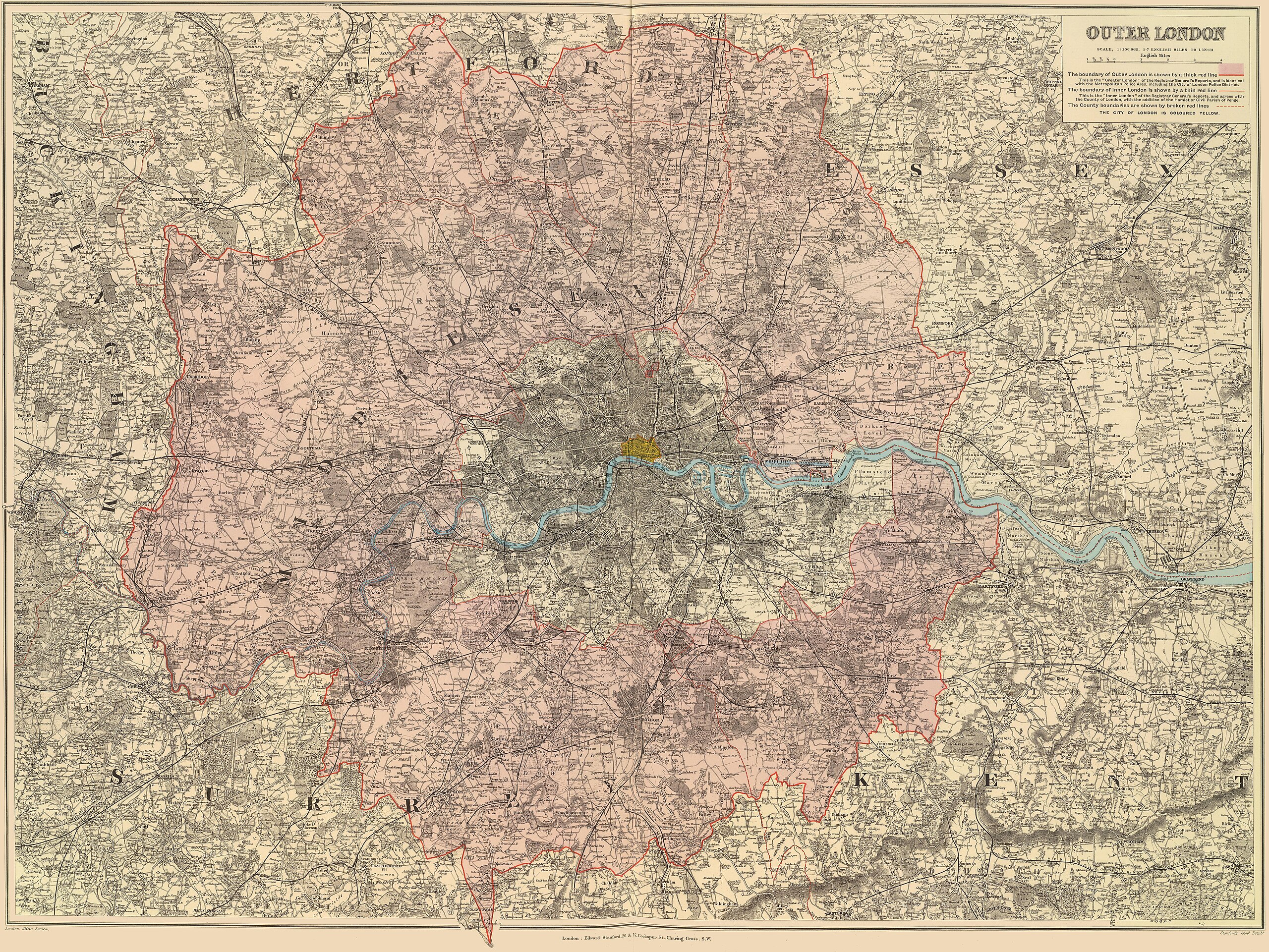
| Description | "Outer London" map showing the area around London with the boundaries of the Metropolitan Police District, the County of London and the City of London highlighted | |||||||||||||||||||
| Date | (Map shows County of London Boundary as it was in 1900: the three portions of South Hornsey Urban District in Middlesex to the south-east of Finsbury Park were merged with Vestry of Stoke Newington in the County of London to form the Metropolitan Borough of Stoke Newington) | |||||||||||||||||||
| Source | Stanford's London Atlas of Universal Geography Exhibiting the Physical and Political Divisions of the Various Countries of the World | |||||||||||||||||||
| Author |
|
|||||||||||||||||||
| Permission (Reusing this file) |
|
|||||||||||||||||||
File history
Click on a date/time to view the file as it appeared at that time.
| Date/Time | Thumbnail | Dimensions | User | Comment | |
|---|---|---|---|---|---|
| current | 19:57, 29 December 2019 | | 10,035 × 7,531 (84.03 MB) | commons>DavidCane | == {{int:filedesc}} == {{Information |Description="Outer London" map showing the area around London with the boundaries of the Metropolitan Police District, the County of London and the City of London highlighted |Source=Stanford's London Atlas of Universal Geography Exhibiting the Physical and Political Divisions of the Various Countries of the World |Date=1901 |Author={{Creator:Edward Stanford}} |Permission={{PD... |
File usage
There are no pages that use this file.