File:St Lucia map.png
Jump to navigation
Jump to search
Size of this preview: 364 × 599 pixels. Other resolutions: 146 × 240 pixels | 291 × 480 pixels | 466 × 768 pixels | 622 × 1,024 pixels | 1,912 × 3,147 pixels.
Original file (1,912 × 3,147 pixels, file size: 4.21 MB, MIME type: image/png)
File history
Click on a date/time to view the file as it appeared at that time.
| Date/Time | Thumbnail | Dimensions | User | Comment | |
|---|---|---|---|---|---|
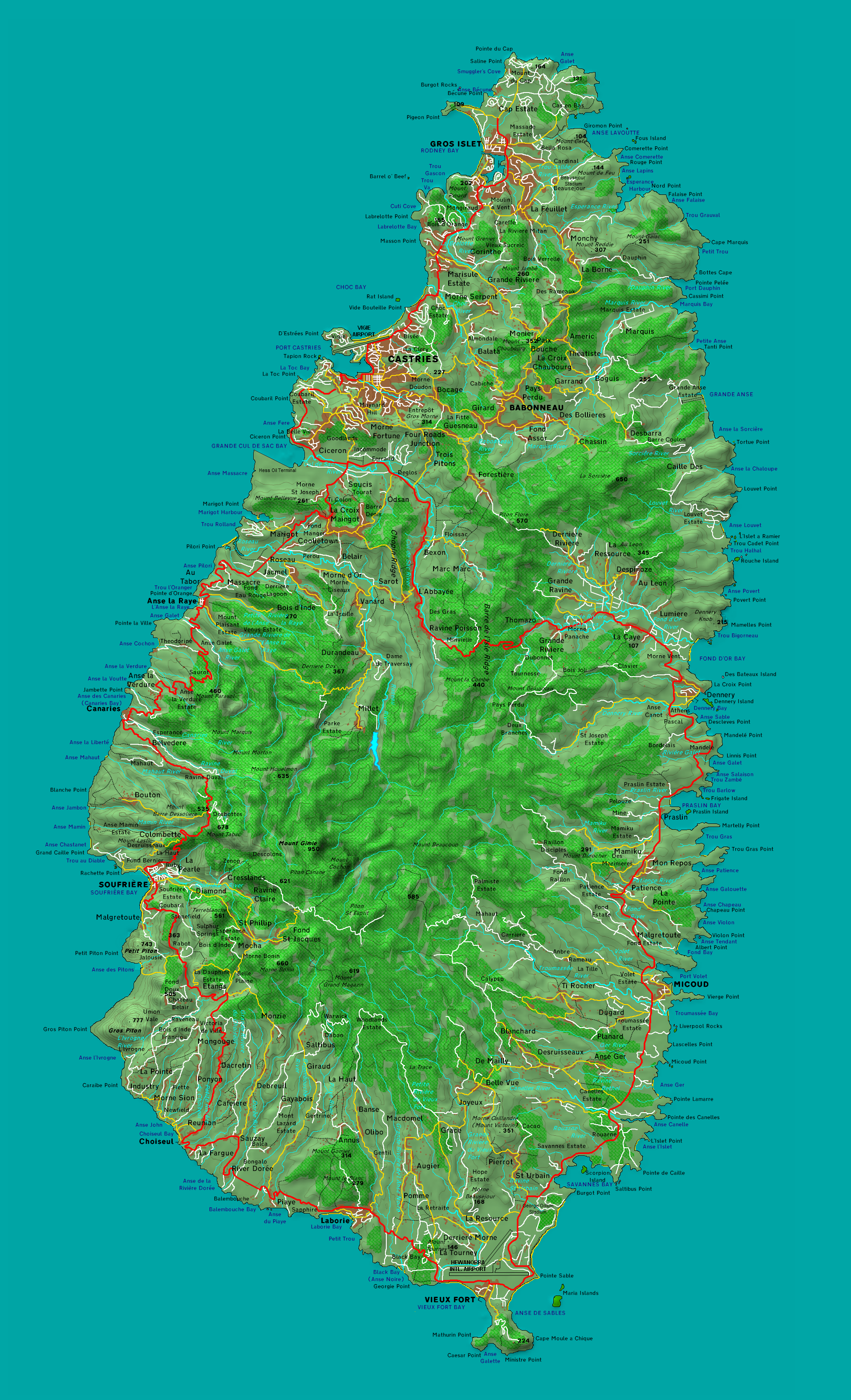
| current | 10:45, 15 April 2010 | | 1,912 × 3,147 (4.21 MB) | commons>Mjr74 | {{Information |Description={{en|1=Map of Saint Lucia}} |Source={{own}} |Author=Mjr74 |Date=2010-04-15 |Permission= |other_versions= }} Category:Geography of Saint Lucia |
File usage
There are no pages that use this file.