File:Special member state territories and the European Union.svg
Jump to navigation
Jump to search

Size of this PNG preview of this SVG file: 512 × 258 pixels. Other resolutions: 320 × 161 pixels | 640 × 323 pixels | 1,024 × 516 pixels | 1,280 × 645 pixels | 2,560 × 1,290 pixels.
Original file (SVG file, nominally 512 × 258 pixels, file size: 835 KB)
Summary
| Description |
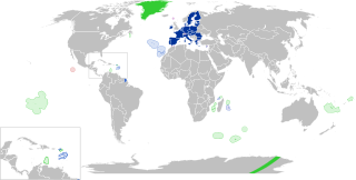
English:
European Union
Outermost regions
Overseas countries and territories
Special cases
Other special territories Français : Union européenne
Régions ultrapériphériques
Pays et territoires d'outre-mer
Cas spéciaux
Autres territoires spéciaux |
| Date | |
| Source | Own work |
| Author | Glentamara |
| SVG development |
Licensing
| I, the copyright holder of this work, release this work into the public domain. This applies worldwide. In some countries this may not be legally possible; if so: I grant anyone the right to use this work for any purpose, without any conditions, unless such conditions are required by law. |
File history
Click on a date/time to view the file as it appeared at that time.
| Date/Time | Thumbnail | Dimensions | User | Comment | |
|---|---|---|---|---|---|
| current | 19:12, 8 June 2022 | | 512 × 258 (835 KB) | commons>Nablicus | new version |
File usage
There are no pages that use this file.