File:South Africa 2011 Coloured population density map.svg
Jump to navigation
Jump to search

Size of this PNG preview of this SVG file: 684 × 599 pixels. Other resolutions: 274 × 240 pixels | 548 × 480 pixels | 876 × 768 pixels | 1,168 × 1,024 pixels | 2,337 × 2,048 pixels | 809 × 709 pixels.
Original file (SVG file, nominally 809 × 709 pixels, file size: 1.13 MB)
File history
Click on a date/time to view the file as it appeared at that time.
| Date/Time | Thumbnail | Dimensions | User | Comment | |
|---|---|---|---|---|---|
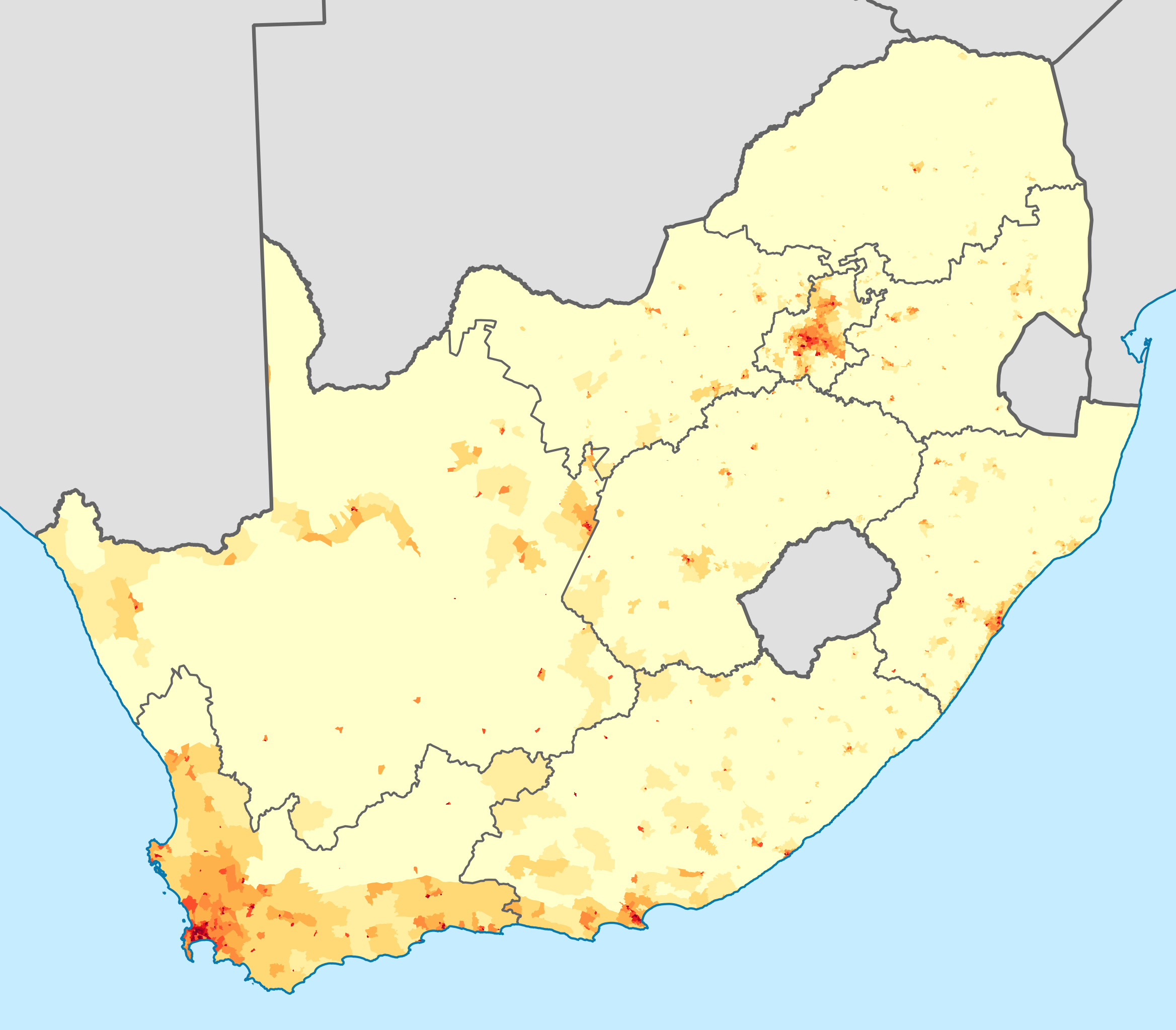
| current | 21:07, 16 April 2013 | | 809 × 709 (1.13 MB) | commons>Htonl | == {{int:filedesc}} == {{Information |Description={{en|1=Density of people in South Africa self-describing as "Coloured", at electoral ward level. {{legend|#ffffcc|<1 person/km²}} {{legend|#ffeda0|1–3 people/km²}} {{legend|#fed976|3–10 people/... |
File usage
There are no pages that use this file.