File:Somers Isles Map - John Speed 1676.jpg
Jump to navigation
Jump to search
Size of this preview: 800 × 519 pixels. Other resolutions: 320 × 208 pixels | 640 × 415 pixels | 1,024 × 665 pixels | 1,280 × 831 pixels | 2,744 × 1,781 pixels.
Original file (2,744 × 1,781 pixels, file size: 2.86 MB, MIME type: image/jpeg)
File history
Click on a date/time to view the file as it appeared at that time.
| Date/Time | Thumbnail | Dimensions | User | Comment | |
|---|---|---|---|---|---|
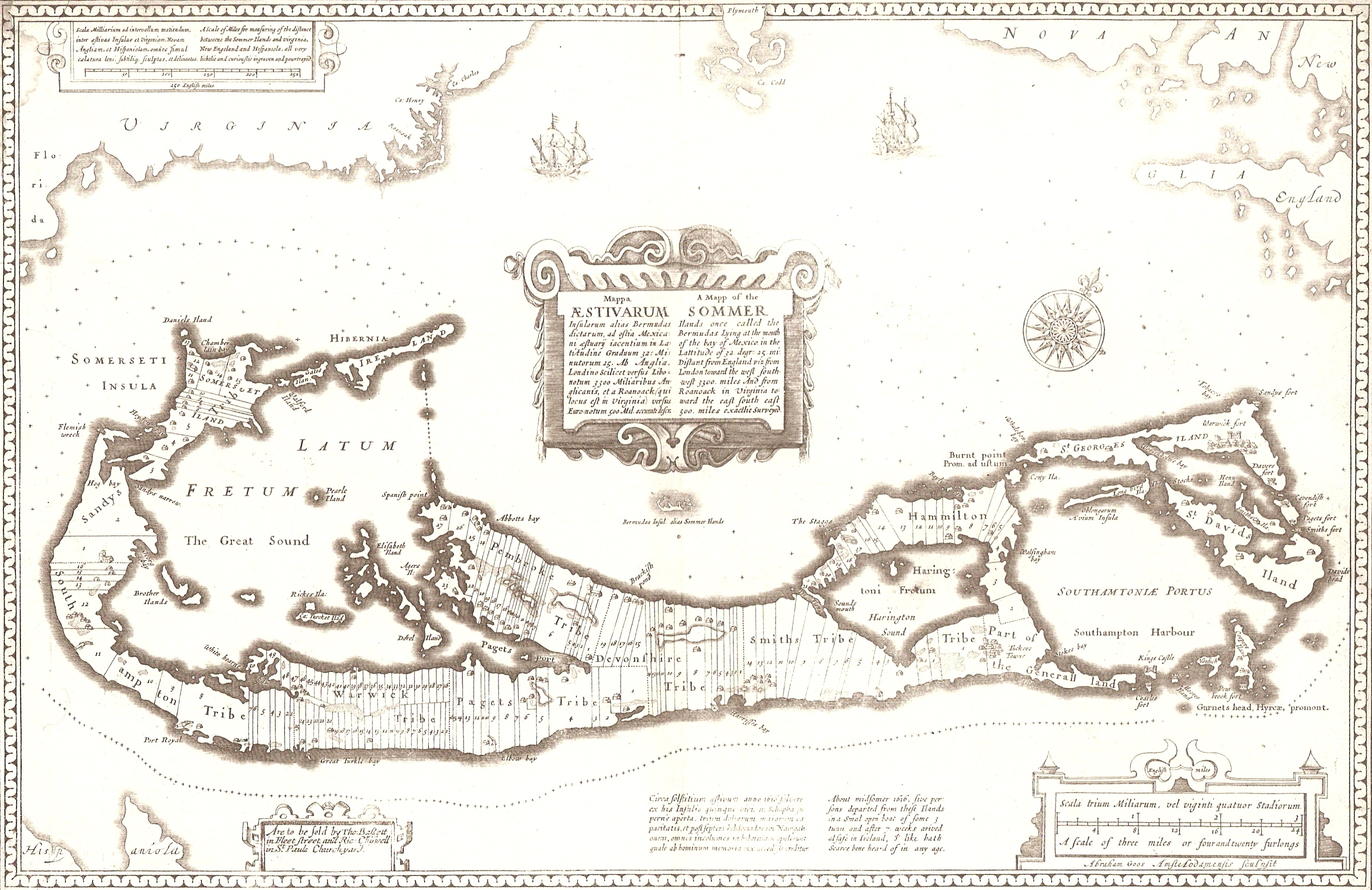
| current | 06:04, 26 February 2007 | | 2,744 × 1,781 (2.86 MB) | commons>Aodhdubh | A 1676 map of the Somers Isles (alias Bermuda), by John Speed (based on the map of surveyor Richard Norwood). Clearly shown are the tribe roads cut parallel through the forest between the North and South Shores (except in St. Georges, the eastern-most sub |
File usage
There are no pages that use this file.