File:Some castles near Heemskerk in 1708.png
Jump to navigation
Jump to search
Size of this preview: 800 × 491 pixels. Other resolutions: 320 × 196 pixels | 640 × 393 pixels | 1,024 × 629 pixels | 1,280 × 786 pixels | 3,216 × 1,974 pixels.
Original file (3,216 × 1,974 pixels, file size: 9.56 MB, MIME type: image/png)
Summary
| Description |
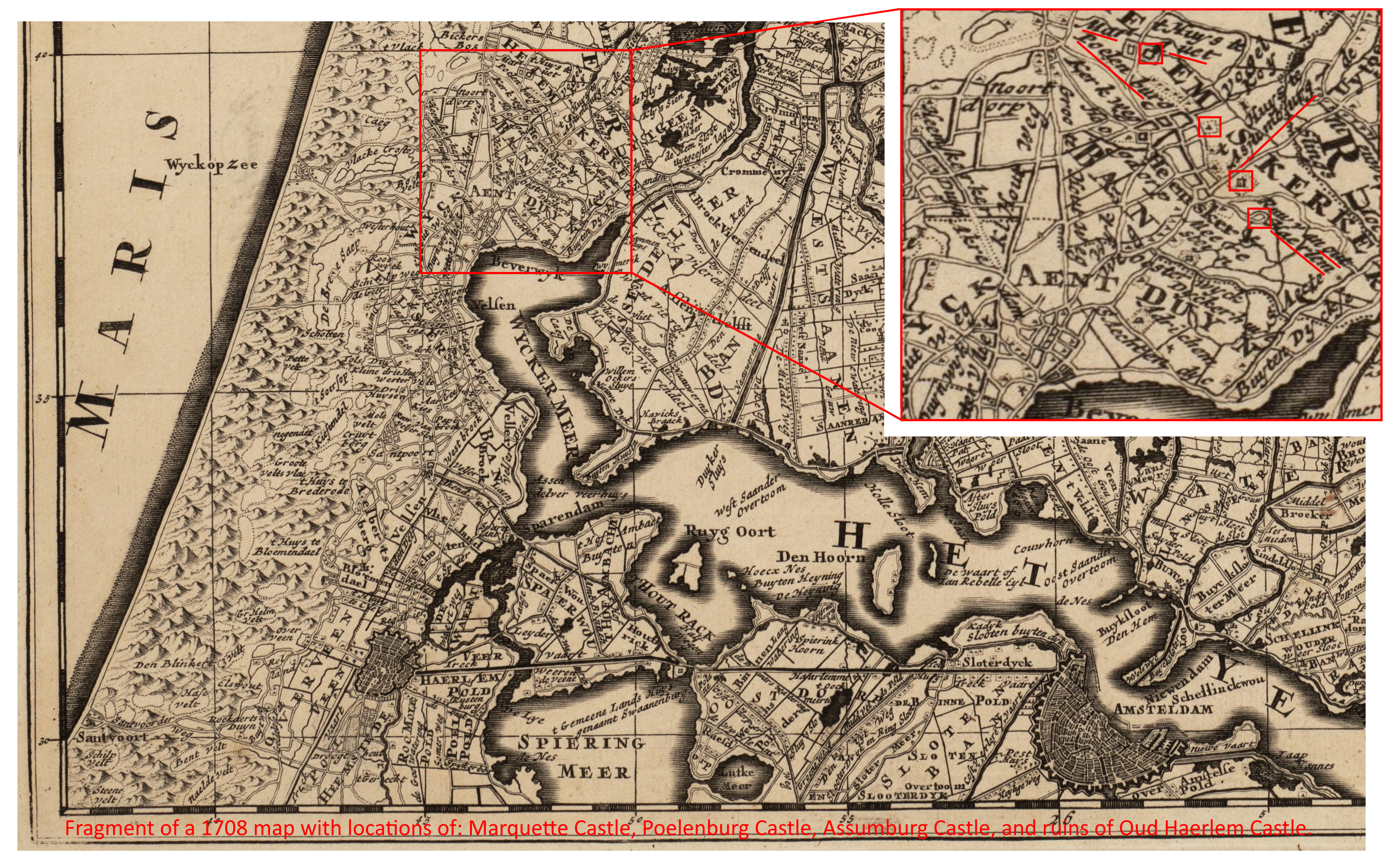
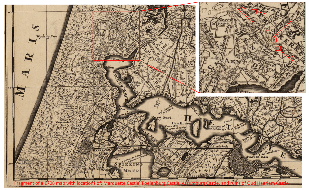
English: Fragment of a 1708 map with locations of some castles near Heemskerk. It shows that these castles were remarkably close to each other.
Nederlands: Uitsnede van een kaart uit 1708 met daarop de locatie van enkele kastelen bij Heemskerk. Deze liggen opvallend dicht bij elkaar. |
| Date | |
| Source | https://www.flickr.com/photos/public-domain-archief-alkmaar/24934184660/ Noord-Holland 1708 Regionaal Archief Alkmaar Commons |
| Author | Peter Schenk, edited by Grieg2 |
| Other versions |
.jpg) |
Licensing
This file is licensed under the Creative Commons Attribution-Share Alike 4.0 International license.
- You are free:
- to share – to copy, distribute and transmit the work
- to remix – to adapt the work
- Under the following conditions:
- attribution – You must give appropriate credit, provide a link to the license, and indicate if changes were made. You may do so in any reasonable manner, but not in any way that suggests the licensor endorses you or your use.
- share alike – If you remix, transform, or build upon the material, you must distribute your contributions under the same or compatible license as the original.
File history
Click on a date/time to view the file as it appeared at that time.
| Date/Time | Thumbnail | Dimensions | User | Comment | |
|---|---|---|---|---|---|
| current | 22:25, 1 January 2022 | | 3,216 × 1,974 (9.56 MB) | commons>Mdd | Adjusted lay out to make clear there are two layers of maps in this one picture |
File usage
There are no pages that use this file.