File:Snohomish River Bridge on SR 529 in 2009.jpg
Jump to navigation
Jump to search
Size of this preview: 800 × 531 pixels. Other resolutions: 320 × 213 pixels | 640 × 425 pixels | 1,024 × 680 pixels | 1,280 × 850 pixels | 2,560 × 1,700 pixels | 4,288 × 2,848 pixels.
Original file (4,288 × 2,848 pixels, file size: 8.66 MB, MIME type: image/jpeg)
Summary
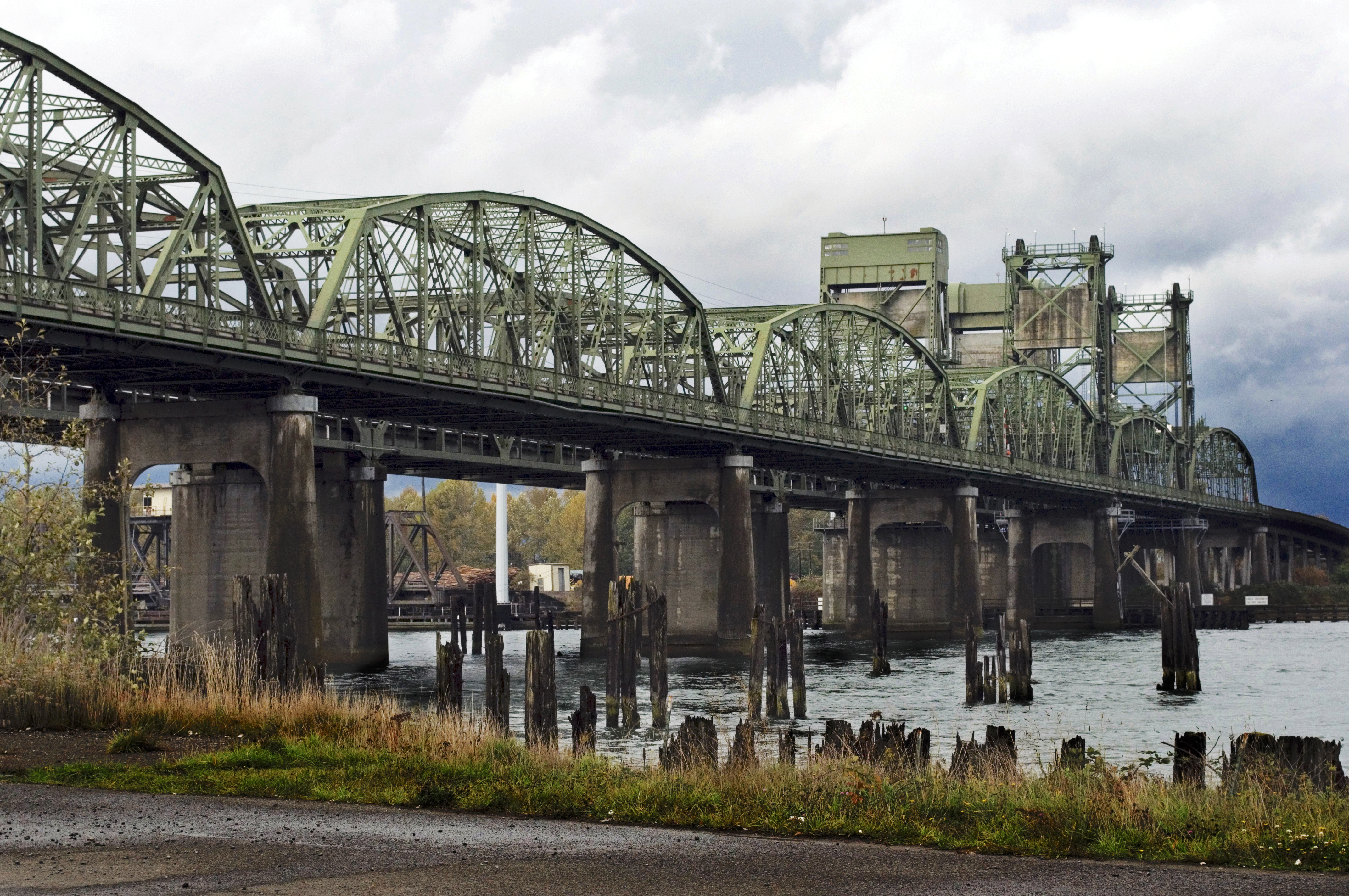
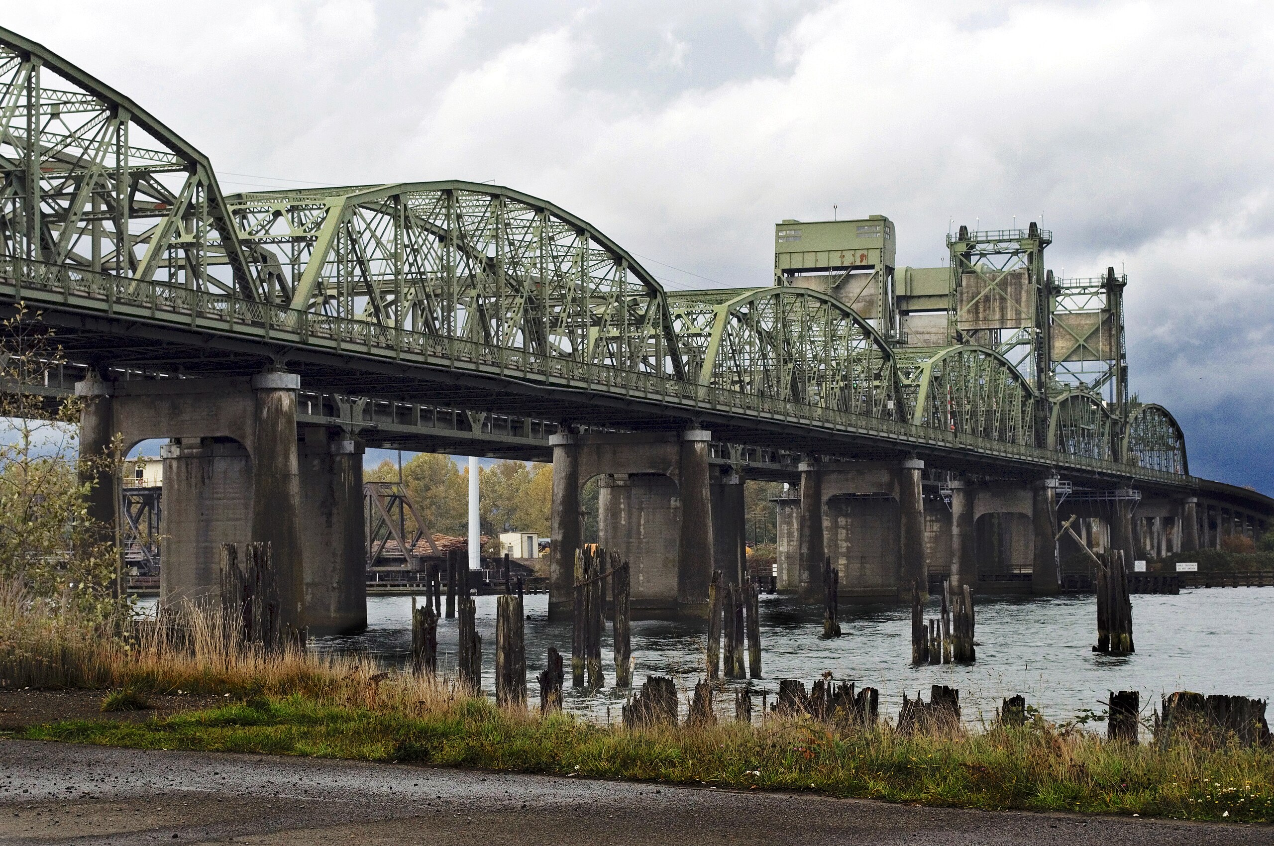
| Description | The Snohomish River Bridge on Washington state highway SR 529, located just north of Everett, Washington, is a pair of truss bridges that each includes a vertical-lift span. This view is from the south-southeast. The northbound bridge, closest to the camera in this photo, was built in 1927 and originally carried two-way traffic. The southbound bridge, visible in the background, was built in 1954 and is wider – as can be seen here from the wider lift towers. In the lower-left background, the swing span of the parallel railroad bridge can be see, turned perpendicular to the rail line – leaving a channel open for river traffic, likely the normal position when no train is nearby. |
| Date | |
| Source | UrbexOct2009_15_RT |
| Author | Evan Wyatt |
| Camera location | | View this and other nearby images on: OpenStreetMap |
|---|
Licensing
This file is licensed under the Creative Commons Attribution 2.0 Generic license.
- You are free:
- to share – to copy, distribute and transmit the work
- to remix – to adapt the work
- Under the following conditions:
- attribution – You must give appropriate credit, provide a link to the license, and indicate if changes were made. You may do so in any reasonable manner, but not in any way that suggests the licensor endorses you or your use.
| This image was originally posted to Flickr by Evan Wyatt at https://flickr.com/photos/39788945@N06/4109817491. It was reviewed on 21 April 2017 by FlickreviewR and was confirmed to be licensed under the terms of the cc-by-2.0. |
File history
Click on a date/time to view the file as it appeared at that time.
| Date/Time | Thumbnail | Dimensions | User | Comment | |
|---|---|---|---|---|---|
| current | 03:52, 21 April 2017 | | 4,288 × 2,848 (8.66 MB) | commons>Steve Morgan | improved shadow detail |
File usage
There are no pages that use this file.