File:Sketch map Samoa in the Pacific.jpg
Jump to navigation
Jump to search
Size of this preview: 780 × 600 pixels. Other resolutions: 312 × 240 pixels | 625 × 480 pixels | 843 × 648 pixels.
Original file (843 × 648 pixels, file size: 104 KB, MIME type: image/jpeg)
File history
Click on a date/time to view the file as it appeared at that time.
| Date/Time | Thumbnail | Dimensions | User | Comment | |
|---|---|---|---|---|---|
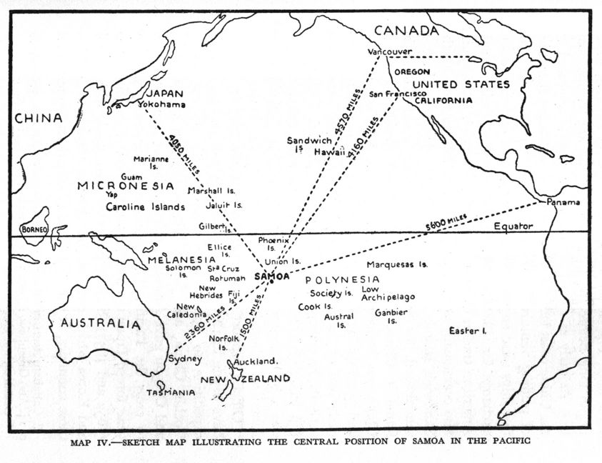
| current | 00:01, 30 June 2010 | | 843 × 648 (104 KB) | commons>Teinesavaii | {{Information |Description={{en|1=Sketch map illustrating the central position of Samoa in the Pacific. }} |Source=[http://www.google.co.nz/imgres?imgurl=http://www.nzetc.org/etexts/MasOrig/MasOrig107a(h280).jpg&imgrefurl=http://www.nzetc.org/tm/scholarly |
File usage
There are no pages that use this file.