File:Selden Island Topo.jpg
Jump to navigation
Jump to search

Size of this preview: 799 × 600 pixels. Other resolutions: 320 × 240 pixels | 640 × 480 pixels | 1,024 × 768 pixels | 1,194 × 896 pixels.
Original file (1,194 × 896 pixels, file size: 407 KB, MIME type: image/jpeg)
File history
Click on a date/time to view the file as it appeared at that time.
| Date/Time | Thumbnail | Dimensions | User | Comment | |
|---|---|---|---|---|---|
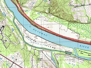
| current | 08:53, 16 February 2011 | | 1,194 × 896 (407 KB) | commons>Wilford Nusser | {{Information |Description ={{en|1=Topographic map of Selden Island, extracted from the USGS 1:24,000 series map of the Stirling quadrangle.}} |Source =http://store.usgs.gov/b2c_usgs/usgs/maplocator/(isQuery=yes&xcm=r3standardpitrex_prd&query=* |
File usage
There are no pages that use this file.