File:Scotia Sea.png
Jump to navigation
Jump to search

Size of this preview: 600 × 600 pixels. Other resolutions: 240 × 240 pixels | 480 × 480 pixels | 726 × 726 pixels.
Original file (726 × 726 pixels, file size: 10 KB, MIME type: image/png)
File history
Click on a date/time to view the file as it appeared at that time.
| Date/Time | Thumbnail | Dimensions | User | Comment | |
|---|---|---|---|---|---|
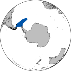
| current | 18:02, 28 August 2006 | | 726 × 726 (10 KB) | commons>Foobaz | This map shows the approximate area of the w:Scotia Sea, based on the description in its article. I created it using Image:Blankmap-ao-090S-south pole.png and w:GraphicConverter. |
File usage
There are no pages that use this file.