File:Saint-Mathieu-Dome.png
Jump to navigation
Jump to search

Size of this preview: 551 × 599 pixels. Other resolutions: 221 × 240 pixels | 441 × 480 pixels | 1,006 × 1,094 pixels.
Original file (1,006 × 1,094 pixels, file size: 192 KB, MIME type: image/png)
File history
Click on a date/time to view the file as it appeared at that time.
| Date/Time | Thumbnail | Dimensions | User | Comment | |
|---|---|---|---|---|---|
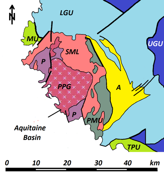
| current | 16:35, 26 January 2012 | | 1,006 × 1,094 (192 KB) | commons>Rudolf Pohl | {{Information |Description ={{en|1=Geological map of the Saint-Mathieu dome in the northwestern French Massif Central. The following abbrevations designate the following units:<br/> PMU - Parautochthonous Micaschist Unit<br/>LGU - Lower Gneiss Unit<br/ |
File usage
There are no pages that use this file.