File:Saint-Martin Island topographic map-en.svg
Jump to navigation
Jump to search

Size of this PNG preview of this SVG file: 795 × 599 pixels. Other resolutions: 319 × 240 pixels | 637 × 480 pixels | 1,019 × 768 pixels | 1,280 × 965 pixels | 2,560 × 1,930 pixels | 2,600 × 1,960 pixels.
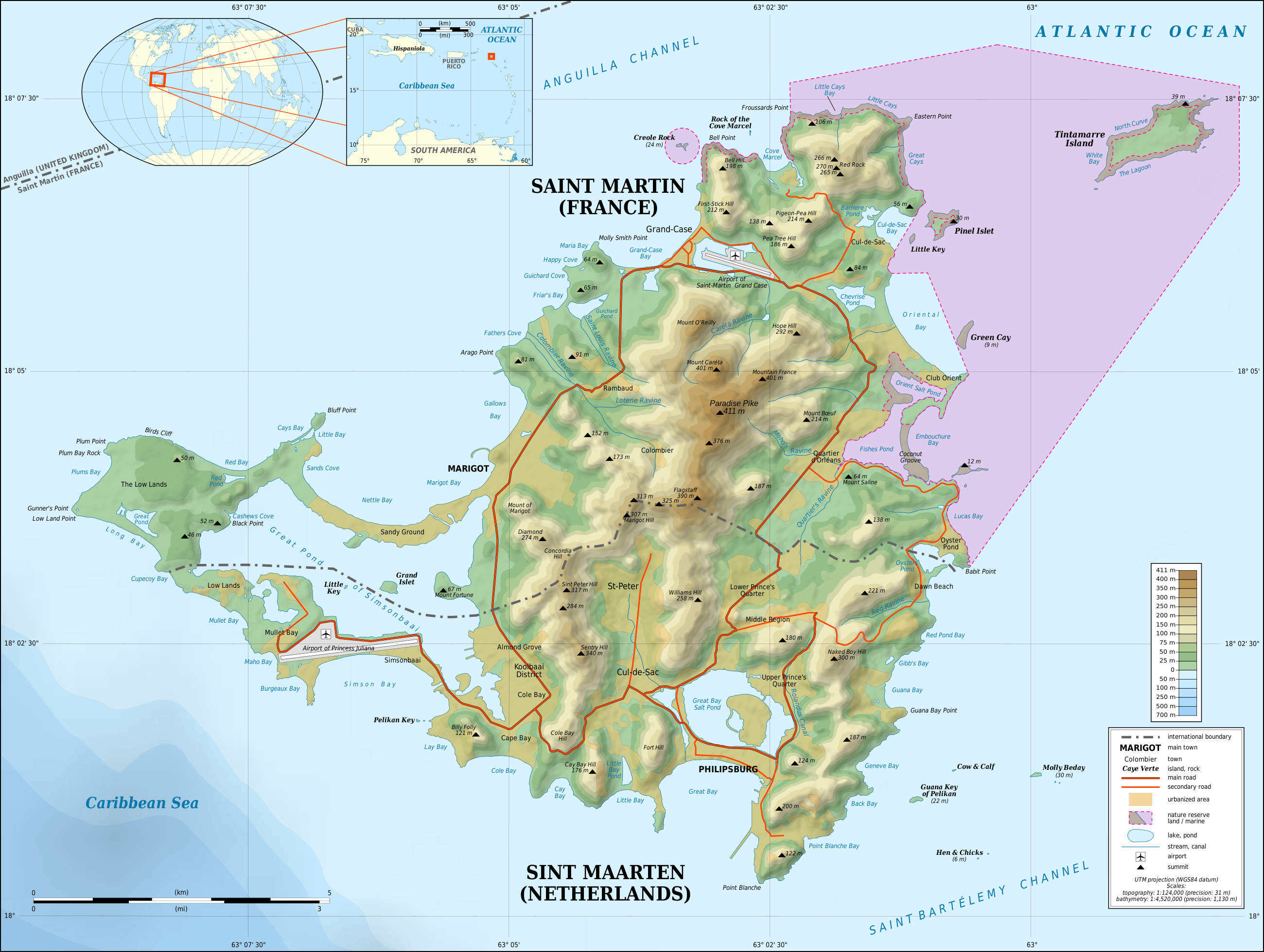
Original file (SVG file, nominally 2,600 × 1,960 pixels, file size: 1.57 MB)
File history
Click on a date/time to view the file as it appeared at that time.
| Date/Time | Thumbnail | Dimensions | User | Comment | |
|---|---|---|---|---|---|
| current | 22:55, 17 October 2015 | | 2,600 × 1,960 (1.57 MB) | commons>Sting | Using NASA SRTM 1 topographic data ; now only the shaded relief is raster |
File usage
There are no pages that use this file.