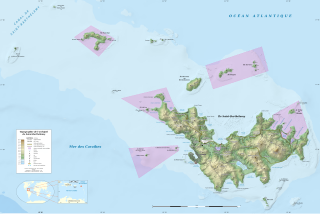
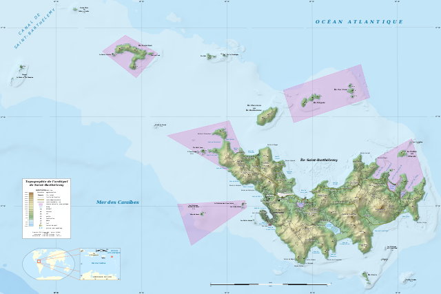
File:Saint-Barthélemy Island topographic map-fr.svg
Jump to navigation
Jump to search

Size of this PNG preview of this SVG file: 800 × 533 pixels. Other resolutions: 320 × 213 pixels | 640 × 427 pixels | 1,024 × 683 pixels | 1,280 × 853 pixels | 2,560 × 1,707 pixels | 5,208 × 3,472 pixels.
Original file (SVG file, nominally 5,208 × 3,472 pixels, file size: 6.7 MB)
File history
Click on a date/time to view the file as it appeared at that time.
| Date/Time | Thumbnail | Dimensions | User | Comment | |
|---|---|---|---|---|---|
| current | 01:55, 26 January 2024 | | 5,208 × 3,472 (6.7 MB) | commons>Sting | Completely new map using updated data; same geographic limits as previous version |
File usage
There are no pages that use this file.