File:SR 123 area history.svg
Jump to navigation
Jump to search

Size of this PNG preview of this SVG file: 800 × 444 pixels. Other resolutions: 320 × 178 pixels | 640 × 356 pixels | 1,024 × 569 pixels | 1,280 × 711 pixels | 2,560 × 1,422 pixels | 1,152 × 640 pixels.
Original file (SVG file, nominally 1,152 × 640 pixels, file size: 29 KB)
File history
Click on a date/time to view the file as it appeared at that time.
| Date/Time | Thumbnail | Dimensions | User | Comment | |
|---|---|---|---|---|---|
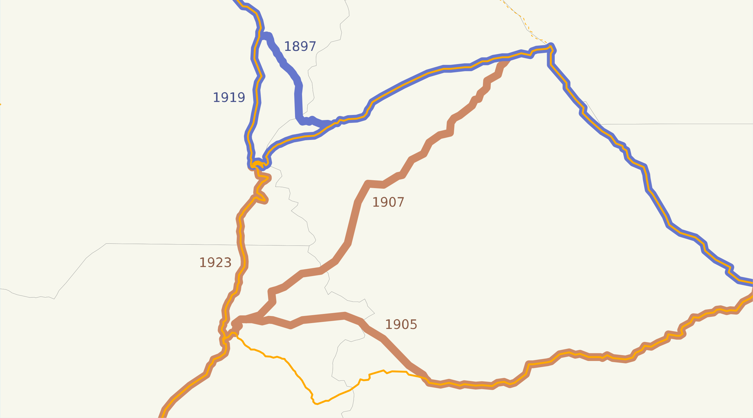
| current | 04:42, 22 March 2008 | | 1,152 × 640 (29 KB) | commons>NE2 | == Summary == This is a map of the highways on the east side of Mount Rainier in Washington. The road on the north, now SR 410, was added to the state highway system in 1897 and moved south in 1919; the road on the south, now US 12 and SR 123, was added i |
File usage
There are no pages that use this file.