File:SC 146 map.svg
Jump to navigation
Jump to search

Size of this PNG preview of this SVG file: 800 × 470 pixels. Other resolutions: 320 × 188 pixels | 640 × 376 pixels | 1,024 × 602 pixels | 1,280 × 753 pixels | 2,560 × 1,505 pixels | 1,204 × 708 pixels.
Original file (SVG file, nominally 1,204 × 708 pixels, file size: 1.08 MB)
File history
Click on a date/time to view the file as it appeared at that time.
| Date/Time | Thumbnail | Dimensions | User | Comment | |
|---|---|---|---|---|---|
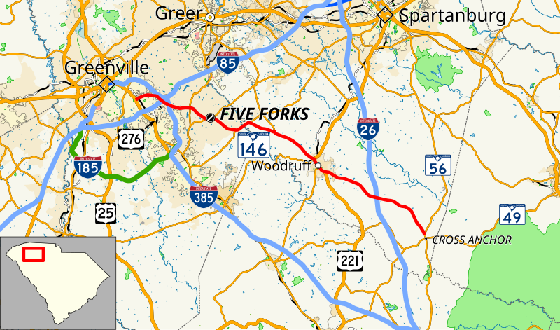
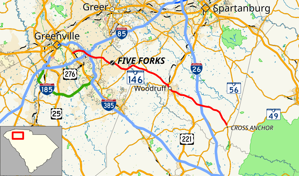
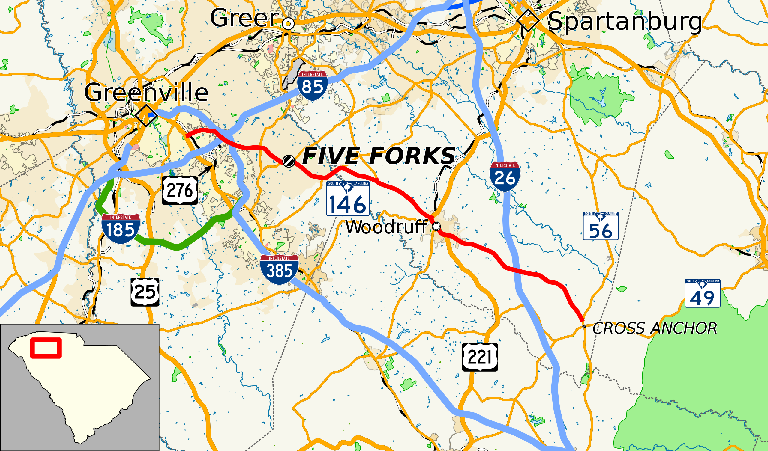
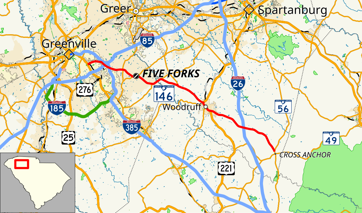
| current | 17:18, 1 May 2018 | | 1,204 × 708 (1.08 MB) | commons>Mr. Matté | == {{int:filedesc}} == {{Information |Description=Map of en:South Carolina Highway 146 |Source={{own}}, data from [https://www.census.gov/cgi-bin/geo/shapefiles/index.php U.S. Census Bureau] and KML files on South Carolina highway articles |other fields={{QGIS}}{{Inkscape}} |Date=2018-05-01 |Author={{User:Mr. Matté/Author template}} }} =={{int:license-header}}== {{cc-by-sa-3.0|1=Mr. Matté}} 146 [[Category:Maps created by User... |
File usage
There are no pages that use this file.