File:Rivers of Makay Mountains OSM.png
Jump to navigation
Jump to search

Size of this preview: 523 × 599 pixels. Other resolutions: 209 × 240 pixels | 419 × 480 pixels | 670 × 768 pixels | 893 × 1,024 pixels | 1,814 × 2,079 pixels.
Original file (1,814 × 2,079 pixels, file size: 5.51 MB, MIME type: image/png)
File history
Click on a date/time to view the file as it appeared at that time.
| Date/Time | Thumbnail | Dimensions | User | Comment | |
|---|---|---|---|---|---|
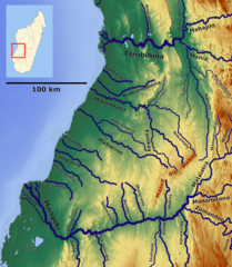
| current | 13:08, 29 March 2021 | | 1,814 × 2,079 (5.51 MB) | commons>Peter in s | {{Information |Description= Rivers of Makay Mountains_OSM. Lower centre west coast Madagascar. Based on US military map SF38 |Source= https://maps-for-free.com, http://legacy.lib.utexas.edu/maps/ams/africa_1m/ |Date= 2021-03-29 |Author= Hans Braxmeier & Peter in s |Permission= |other_versions= }} {{cc-by-sa-2.0}} Category:Maps of rivers of Madagascar |
File usage
There are no pages that use this file.