File:Rim Village map, 2002.jpg
Jump to navigation
Jump to search
No higher resolution available.
Rim_Village_map,_2002.jpg (561 × 309 pixels, file size: 43 KB, MIME type: image/jpeg)
File history
Click on a date/time to view the file as it appeared at that time.
| Date/Time | Thumbnail | Dimensions | User | Comment | |
|---|---|---|---|---|---|
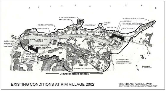
| current | 23:46, 7 August 2008 | | 561 × 309 (43 KB) | commons>Werewombat | {{Information |Description={{en|Map of the en:Rim Village Historic District in en:Crater Lake National Park, en:Oregon, en:United States.}} |Source=http://www.craterlakeinstitute.com/online-library/rim-village-cli/site.htm<br/>''Tr |
File usage
There are no pages that use this file.