File:Rigby map 1911.png
Jump to navigation
Jump to search
Size of this preview: 800 × 444 pixels. Other resolutions: 320 × 178 pixels | 640 × 355 pixels | 1,024 × 569 pixels | 1,430 × 794 pixels.
Original file (1,430 × 794 pixels, file size: 1.52 MB, MIME type: image/png)
Summary
| Description |
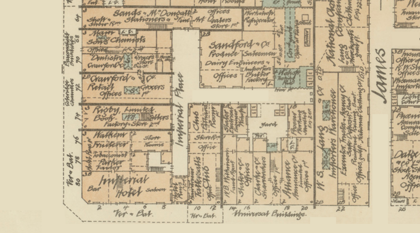
English: Section of 1911 plan of Adelaide surveyed and drawn for Underwriters Association of South Australia. Includes Sands & McDougall's, Rigby's, Imperial Hotel, Tattersall's Club, Sandford & Co. |
| Date | |
| Source | https://collections.slsa.sa.gov.au/resource/C+112/03 |
| Author | Unknown author |
Licensing
|
This work is in the public domain in its country of origin and other countries and areas where the copyright term is the author's life plus 70 years or fewer. This work is in the public domain in the United States because it was published (or registered with the U.S. Copyright Office) before January 1, 1929. | |
| This file has been identified as being free of known restrictions under copyright law, including all related and neighboring rights. | |
File history
Click on a date/time to view the file as it appeared at that time.
| Date/Time | Thumbnail | Dimensions | User | Comment | |
|---|---|---|---|---|---|
| current | 13:14, 15 February 2022 | | 1,430 × 794 (1.52 MB) | commons>Doug butler | Uploaded a work by not known from https://collections.slsa.sa.gov.au/resource/C+112/03 with UploadWizard |
File usage
There are no pages that use this file.