File:Reisimine Nõukogude Liidus.jpg
Jump to navigation
Jump to search

Size of this preview: 800 × 600 pixels. Other resolutions: 320 × 240 pixels | 640 × 480 pixels | 1,024 × 768 pixels | 1,280 × 960 pixels | 2,560 × 1,920 pixels | 4,608 × 3,456 pixels.
Original file (4,608 × 3,456 pixels, file size: 7.67 MB, MIME type: image/jpeg)
File history
Click on a date/time to view the file as it appeared at that time.
| Date/Time | Thumbnail | Dimensions | User | Comment | |
|---|---|---|---|---|---|
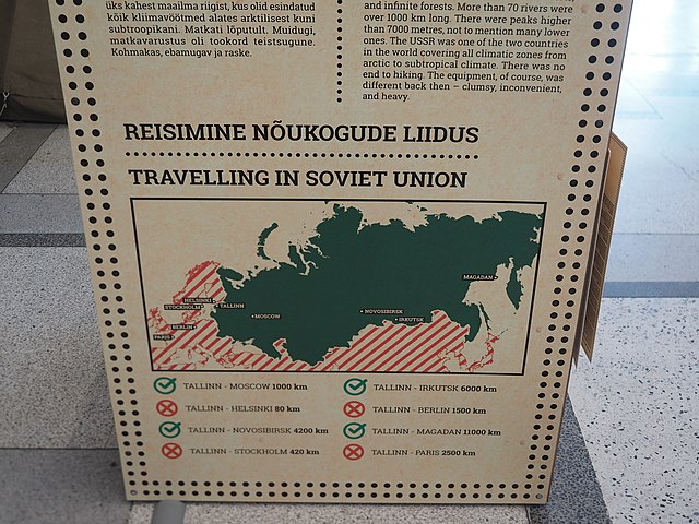
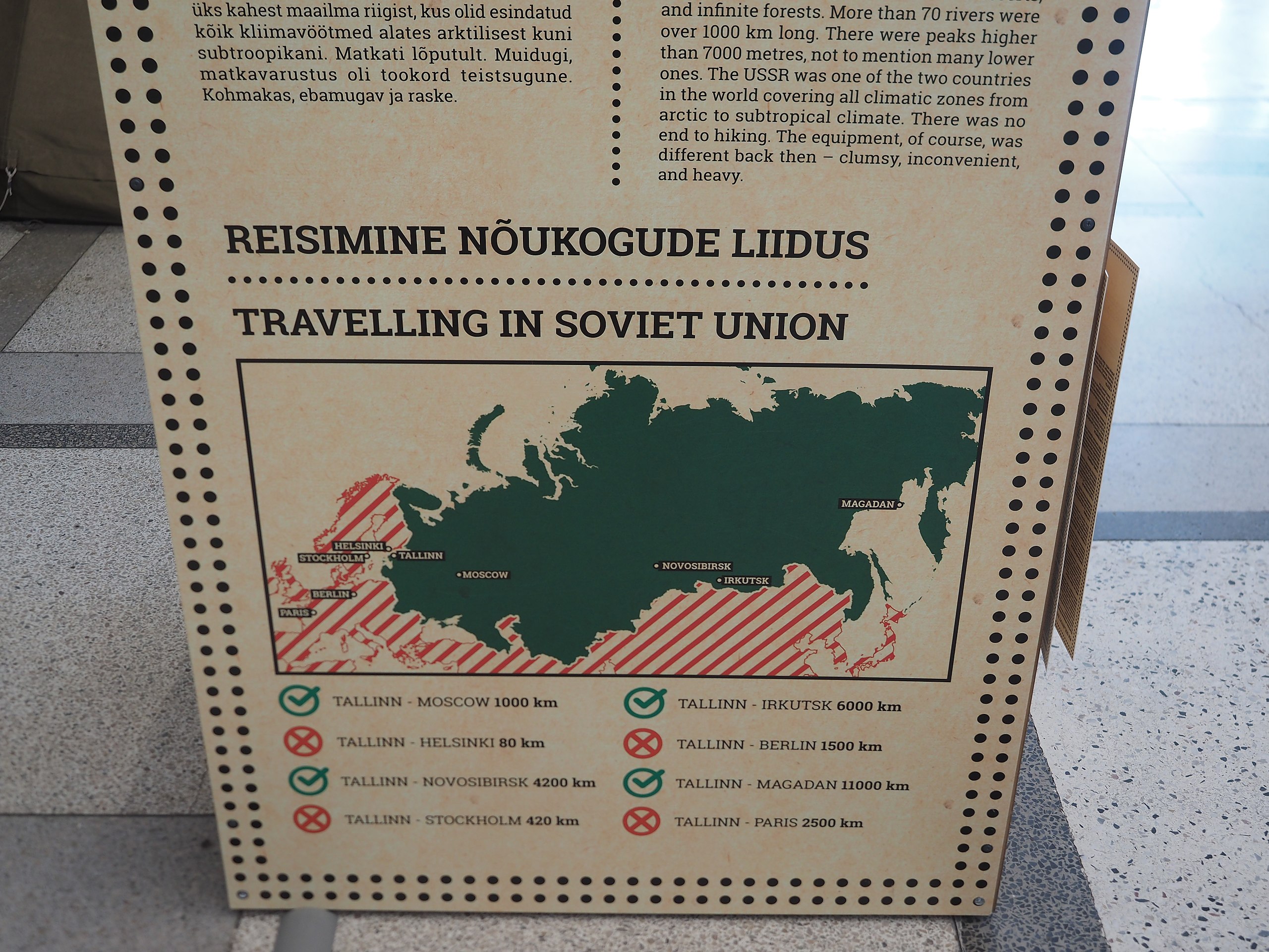
| current | 16:18, 24 December 2020 | | 4,608 × 3,456 (7.67 MB) | commons>JIP | {{Information |Description=A map showing where Estonians could travel (solid green area) and could not travel (striped red area) during the half of a century Estonia spent as a state in the Soviet Union, photographed at a museum in central Tallinn, Estonia. |Source={{own}} |Date=2019-06-15 |Author= JIP |Permission= |other_versions= }} Category:Maps of Eurasia Category:Maps of the Soviet Union Category:Estonian language signs Category:English language signs [[Cate... |
File usage
There are no pages that use this file.