File:Reichenau an der Rax - Raxalm-Berggasthof.JPG
Jump to navigation
Jump to search

Size of this preview: 800 × 533 pixels. Other resolutions: 320 × 213 pixels | 640 × 427 pixels | 1,024 × 683 pixels | 1,280 × 853 pixels | 2,560 × 1,707 pixels | 4,251 × 2,834 pixels.
Original file (4,251 × 2,834 pixels, file size: 10.43 MB, MIME type: image/jpeg)
Summary
| Description |
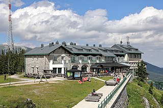
Deutsch: Südwestansicht des Raxalm-Berggasthofes auf der Rax in der niederösterreichischen Marktgemeinde Reichenau an der Rax und ganz rechts die direkt angebaute Bergstation der Raxseilbahn. Der Gebäudekomplex aus Bruchstein mit Verputzelementen wurde im Zuge der Errichtung der 1. Seilschwebebahn Österreichs 1925/26 gebaut. |
| Date | |
| Source | Own work |
| Author | C.Stadler/Bwag |
| Permission (Reusing this file) |
Deutsch: Hallo, du darfst mein Foto kostenlos nutzen, aber nenne mich bitte als Fotograf, beispielsweise „Foto: C.Stadler/Bwag“ oder © C.Stadler/Bwag; CC-BY-SA-4.0. Auf mehr Angaben bestehe ich nicht - im Gegensatz zu manch anderen, die die Vorgaben der unten angeführten Lizenzierung auf Punkt und Beistrich einfordern. English: Feel free to use my photos, but please mention me as the author like © C.Stadler/Bwag or © C.Stadler/Bwag; CC-BY-SA-4.0 (that's good enough) and if you want send me a message: bwag@gmx.net. |
| Object location | | View this and other nearby images on: OpenStreetMap |
|---|
| Camera location | | View this and other nearby images on: OpenStreetMap |
|---|
Licensing
I, the copyright holder of this work, hereby publish it under the following license:
This file is licensed under the Creative Commons Attribution-Share Alike 4.0 International license.
- You are free:
- to share – to copy, distribute and transmit the work
- to remix – to adapt the work
- Under the following conditions:
- attribution – You must give appropriate credit, provide a link to the license, and indicate if changes were made. You may do so in any reasonable manner, but not in any way that suggests the licensor endorses you or your use.
- share alike – If you remix, transform, or build upon the material, you must distribute your contributions under the same or compatible license as the original.
File history
Click on a date/time to view the file as it appeared at that time.
| Date/Time | Thumbnail | Dimensions | User | Comment | |
|---|---|---|---|---|---|
| current | 21:34, 2 July 2018 | | 4,251 × 2,834 (10.43 MB) | commons>Bwag | m |
File usage
There are no pages that use this file.