File:Rand, McNally and Co. Map of the Houston and Texas Central Railway 1880 UTA.jpg
Jump to navigation
Jump to search

Size of this preview: 596 × 600 pixels. Other resolutions: 239 × 240 pixels | 477 × 480 pixels | 763 × 768 pixels | 1,018 × 1,024 pixels | 2,036 × 2,048 pixels | 8,476 × 8,528 pixels.
Original file (8,476 × 8,528 pixels, file size: 11.04 MB, MIME type: image/jpeg)
File history
Click on a date/time to view the file as it appeared at that time.
| Date/Time | Thumbnail | Dimensions | User | Comment | |
|---|---|---|---|---|---|
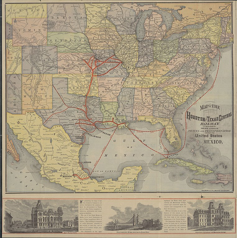
| current | 21:37, 2 April 2022 | | 8,476 × 8,528 (11.04 MB) | commons>Michael Barera | == {{int:filedesc}} == {{Map |title = {{en|'''''Map of the Houston and Texas Central Railway. The New Avenue of Travel and Transportation Between the United States and Mexico'''''}} |description = {{en|This folding railroad promotional brochure map is a fine example of a late nineteenth-century American railway map by one of the most important American railway mapmakers and publishers still in business today: Rand, McNally and Company of Chicago. Established in 1858 as a p... |
File usage
There are no pages that use this file.