File:Queen Charlotte Islands Map.png
Jump to navigation
Jump to search

Size of this preview: 392 × 600 pixels. Other resolutions: 157 × 240 pixels | 496 × 759 pixels.
Original file (496 × 759 pixels, file size: 23 KB, MIME type: image/png)
File history
Click on a date/time to view the file as it appeared at that time.
| Date/Time | Thumbnail | Dimensions | User | Comment | |
|---|---|---|---|---|---|
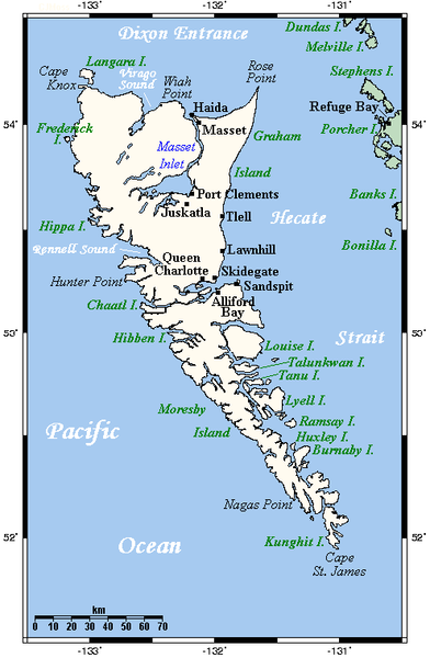
| current | 05:59, 14 September 2007 | | 496 × 759 (23 KB) | commons>TCY | == Summary == A map showing Haida Gwaii's main towns and other physical features. This map's source is [http://www.aquarius.ifm-geomar.de/ here], with the uploader's modifications, and the [http://gmt.soest.hawaii.edu/ GMT homepage] says that the tools ar |
File usage
There are no pages that use this file.