File:Port Pirie's six railway stations from 1876 to the 2010s.png
Jump to navigation
Jump to search
Size of this preview: 800 × 566 pixels. Other resolutions: 320 × 226 pixels | 640 × 453 pixels | 1,024 × 724 pixels | 1,280 × 905 pixels | 2,560 × 1,810 pixels | 3,507 × 2,480 pixels.
Original file (3,507 × 2,480 pixels, file size: 883 KB, MIME type: image/png)
Summary
| Description |
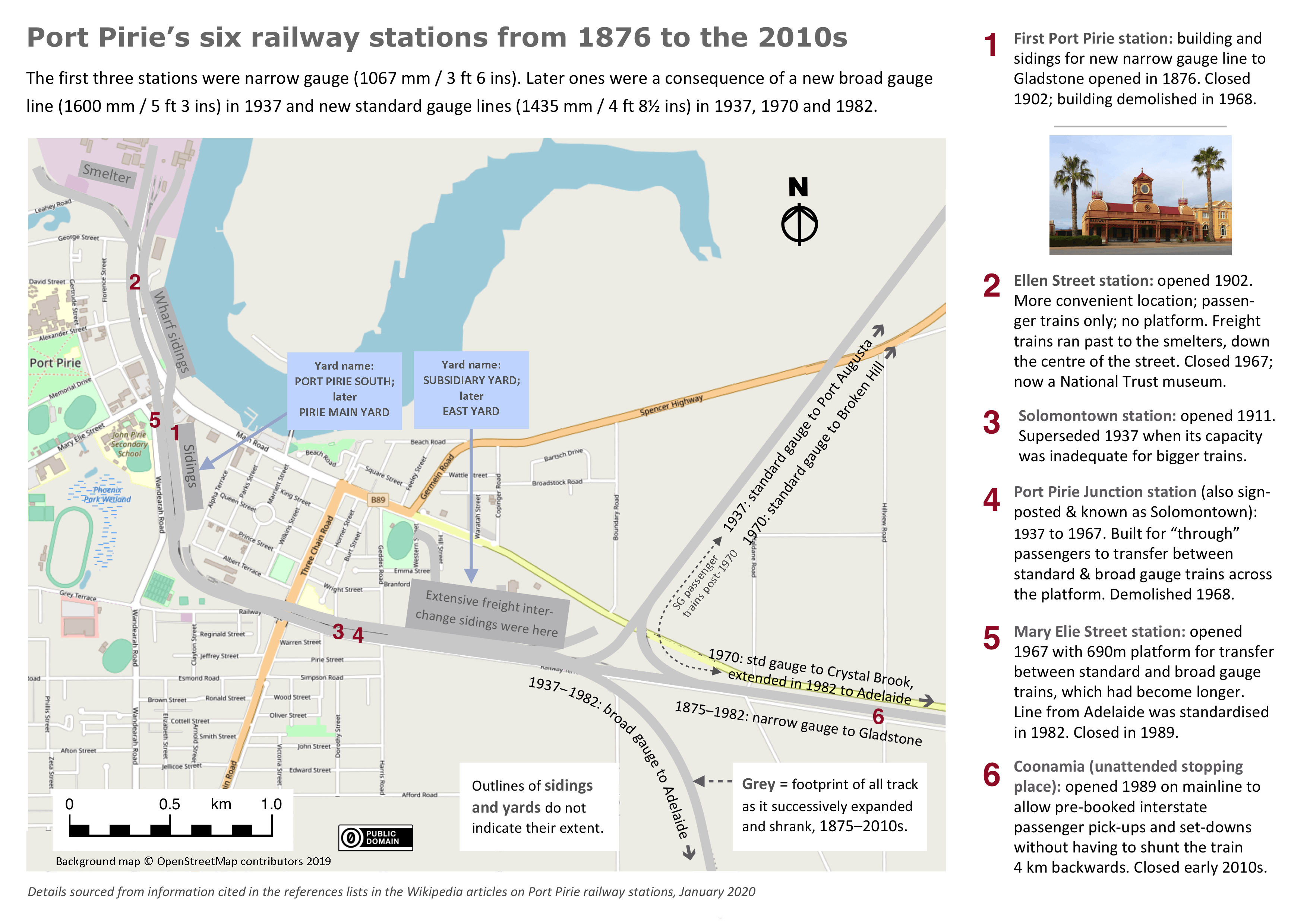
English: Map of Port Pirie, South Australia, with railway routes and stations from 1876 to the 2010s |
| Date | |
| Source | Own work |
| Author | SCHolar44 |
| Camera location | | View this and other nearby images on: OpenStreetMap |
|---|
Licensing
I, the copyright holder of this work, hereby publish it under the following license:
| This file is made available under the Creative Commons CC0 1.0 Universal Public Domain Dedication. | |
| The person who associated a work with this deed has dedicated the work to the public domain by waiving all of their rights to the work worldwide under copyright law, including all related and neighboring rights, to the extent allowed by law. You can copy, modify, distribute and perform the work, even for commercial purposes, all without asking permission.
|
File history
Click on a date/time to view the file as it appeared at that time.
| Date/Time | Thumbnail | Dimensions | User | Comment | |
|---|---|---|---|---|---|
| current | 22:41, 27 January 2020 | | 3,507 × 2,480 (883 KB) | commons>SCHolar44 | Improved my earlier descriptions in sidebar, clarified route of standard gauge passenger trains post-1970. |
File usage
There are no pages that use this file.