File:Poplar Forest VA1.jpg
Original file (3,648 × 5,700 pixels, file size: 15.32 MB, MIME type: image/jpeg)
This file is from a shared repository and may be used by other projects. The description on its file description page there is shown below.
Summary
DescriptionPoplar Forest VA1.jpg |
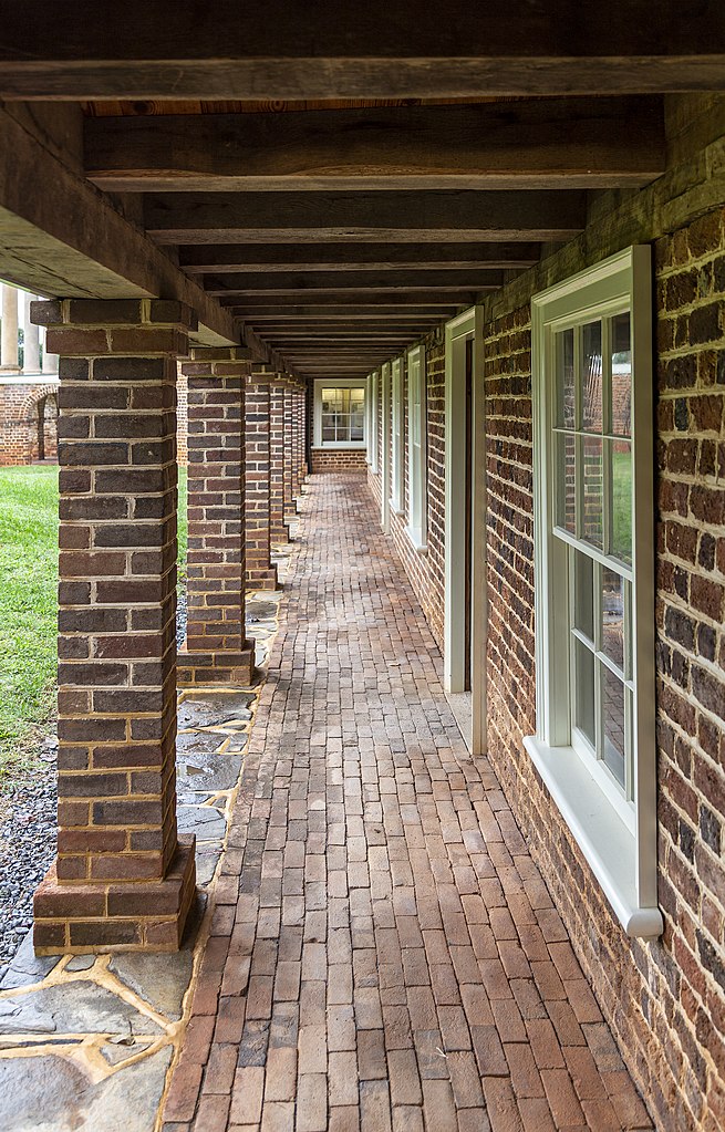
English: View along one of the wings, Poplar Forest, near Lynchburg, Virginia, USA
Français : Découvre le long d'une des ailes, forêt de peupliers, près de Lynchburg, en Virginie, Etats-Unis
|
||
Date | |||
Source | Own work | ||
Author | Acroterion |
Camera location | 37° 20′ 52.71″ N, 79° 15′ 50.75″ W | View this and other nearby images on: OpenStreetMap | 37.347975; -79.264097 |
---|
Licensing
Permission is granted to copy, distribute and/or modify this document under the terms of the GNU Free Documentation License, Version 1.2 or any later version published by the Free Software Foundation; with no Invariant Sections, no Front-Cover Texts, and no Back-Cover Texts. A copy of the license is included in the section entitled GNU Free Documentation License.http://www.gnu.org/copyleft/fdl.htmlGFDLGNU Free Documentation Licensetruetrue |
- You are free:
- to share – to copy, distribute and transmit the work
- to remix – to adapt the work
- Under the following conditions:
- attribution – You must give appropriate credit, provide a link to the license, and indicate if changes were made. You may do so in any reasonable manner, but not in any way that suggests the licensor endorses you or your use.
- share alike – If you remix, transform, or build upon the material, you must distribute your contributions under the same or compatible license as the original.
This image was uploaded as part of Wiki Loves Monuments 2019.
Afrikaans ∙ Alemannisch ∙ azərbaycanca ∙ Bahasa Indonesia ∙ Bahasa Melayu ∙ Bikol Central ∙ bosanski ∙ brezhoneg ∙ català ∙ čeština ∙ Cymraeg ∙ dansk ∙ davvisámegiella ∙ Deutsch ∙ eesti ∙ English ∙ español ∙ Esperanto ∙ euskara ∙ français ∙ Frysk ∙ Gaeilge ∙ galego ∙ hrvatski ∙ Ido ∙ italiano ∙ latviešu ∙ Lëtzebuergesch ∙ Malagasy ∙ magyar ∙ Malti ∙ Nederlands ∙ norsk ∙ norsk nynorsk ∙ norsk bokmål ∙ polski ∙ português ∙ português do Brasil ∙ română ∙ shqip ∙ sicilianu ∙ slovenčina ∙ slovenščina ∙ suomi ∙ svenska ∙ Tagalog ∙ Türkçe ∙ Yorùbá ∙ Zazaki ∙ Ελληνικά ∙ беларуская ∙ беларуская (тарашкевіца) ∙ български ∙ кыргызча ∙ македонски ∙ русский ∙ српски / srpski ∙ українська ∙ ქართული ∙ հայերեն ∙ नेपाली ∙ हिन्दी ∙ বাংলা ∙ മലയാളം ∙ ไทย ∙ 한국어 ∙ +/− |
Items portrayed in this file
depicts
7 October 2016
37°20'52.710"N, 79°15'50.749"W
File history
Click on a date/time to view the file as it appeared at that time.
Date/Time | Thumbnail | Dimensions | User | Comment | |
---|---|---|---|---|---|
current | 15:50, 8 September 2019 | 3,648 × 5,700 (15.32 MB) | commons>Acroterion | {{Information |description ={{en|1=View along one of the wings, Poplar Forest, near Lynchburg, Virginia, USA}} |date =2016-10-07 |source ={{own}} |author =Acroterion }} Category:Poplar Forest |
File usage
There are no pages that use this file.
Metadata
This file contains additional information, probably added from the digital camera or scanner used to create or digitize it.
If the file has been modified from its original state, some details may not fully reflect the modified file.
Camera manufacturer | Canon |
---|---|
Camera model | Canon EOS 6D |
Exposure time | 1/40 sec (0.025) |
F Number | f/4.5 |
ISO speed rating | 100 |
Date and time of data generation | 15:45, 7 October 2016 |
Lens focal length | 32 mm |
Latitude | 37° 20′ 52.71″ N |
Longitude | 79° 15′ 50.75″ W |
Altitude | 271.6 meters above sea level |
Orientation | Normal |
Horizontal resolution | 300 dpi |
Vertical resolution | 300 dpi |
Software used | Adobe Photoshop CC 2019 (Windows) |
File change date and time | 20:52, 7 September 2019 |
Exposure Program | Normal program |
Exif version | 2.3 |
Date and time of digitizing | 15:45, 7 October 2016 |
APEX shutter speed | 5.321928 |
APEX aperture | 4.33985 |
APEX exposure bias | 0 |
Maximum land aperture | 4 APEX (f/4) |
Metering mode | Center weighted average |
Flash | Flash did not fire, compulsory flash suppression |
DateTime subseconds | 00 |
DateTimeOriginal subseconds | 00 |
DateTimeDigitized subseconds | 00 |
Color space | Uncalibrated |
Focal plane X resolution | 1,520 |
Focal plane Y resolution | 1,520 |
Focal plane resolution unit | 3 |
Custom image processing | Normal process |
Exposure mode | Auto exposure |
White balance | Auto white balance |
Scene capture type | Standard |
GPS time (atomic clock) | 15:44 |
Satellites used for measurement | 12 |
Receiver status | Measurement in progress |
Measurement mode | 3-dimensional measurement |
Measurement precision | Poor (5.4) |
Geodetic survey data used | WGS-84 |
GPS date | 7 October 2016 |
GPS tag version | 0.0.3.2 |
Serial number of camera | 122025005461 |
Lens used | EF24-105mm f/4L IS USM |
Rating (out of 5) | 0 |
Date metadata was last modified | 16:52, 7 September 2019 |
Unique ID of original document | F8D54C9FD72F56630ADE716D17A1BA02 |