File:Polk County.svg
Jump to navigation
Jump to search

Size of this PNG preview of this SVG file: 630 × 450 pixels. Other resolutions: 320 × 229 pixels | 640 × 457 pixels | 1,024 × 731 pixels | 1,280 × 914 pixels | 2,560 × 1,829 pixels.
Original file (SVG file, nominally 630 × 450 pixels, file size: 3.15 MB)
Summary
| Description |
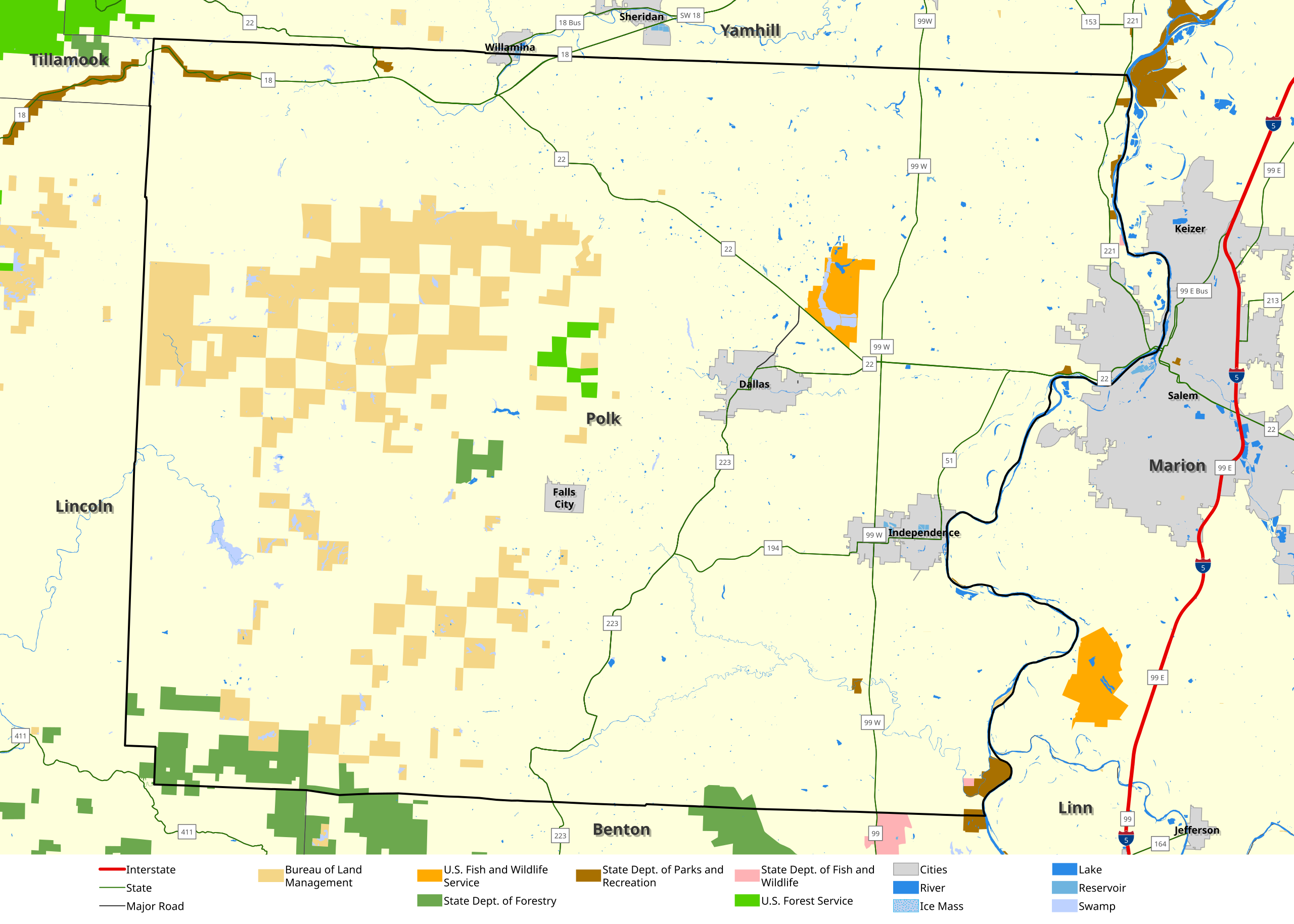
English: This map shows major highways and roads, cities and federal and state land withing Polk County. This map was created in ArcGIS Pro, with data from the Oregon Department of Transportation, the United States Bureau of Land Management and the United States Census Bureau. |
| Date | |
| Source | Own work |
| Author | LaMamelle |
Licensing
I, the copyright holder of this work, hereby publish it under the following license:
This file is licensed under the Creative Commons Attribution-Share Alike 4.0 International license.
- You are free:
- to share – to copy, distribute and transmit the work
- to remix – to adapt the work
- Under the following conditions:
- attribution – You must give appropriate credit, provide a link to the license, and indicate if changes were made. You may do so in any reasonable manner, but not in any way that suggests the licensor endorses you or your use.
- share alike – If you remix, transform, or build upon the material, you must distribute your contributions under the same or compatible license as the original.
File history
Click on a date/time to view the file as it appeared at that time.
| Date/Time | Thumbnail | Dimensions | User | Comment | |
|---|---|---|---|---|---|
| current | 04:00, 2 March 2023 | | 630 × 450 (3.15 MB) | commons>LaMamelle | Uploaded own work with UploadWizard |
File usage
There are no pages that use this file.