File:Polen Galizien Wolhynien.png
Jump to navigation
Jump to search

Size of this preview: 688 × 600 pixels. Other resolutions: 275 × 240 pixels | 551 × 480 pixels | 700 × 610 pixels.
Original file (700 × 610 pixels, file size: 152 KB, MIME type: image/png)

|
This historical map image could be re-created using vector graphics as an SVG file. This has several advantages; see Commons:Media for cleanup for more information. If an SVG form of this image is available, please upload it and afterwards replace this template with
{{vector version available|new image name}}.
It is recommended to name the SVG file “Polen Galizien Wolhynien.svg”—then the template Vector version available (or Vva) does not need the new image name parameter. |

|
The copyright holder of this file, Kai Kotzian, allows anyone to use it for any purpose, provided that the copyright holder is properly attributed. Redistribution, derivative work, commercial use, and all other use is permitted. |
Attribution:
Kai Kotzian, year of creation: 2005 (must include all)
|
Die Copyrighthinweise sind zu achten!
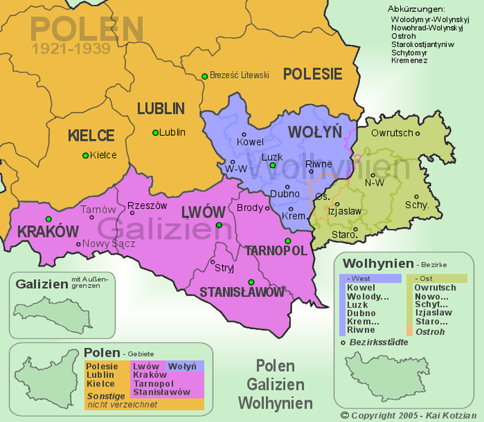
Die Ansicht zeigt den südöstlichen Teil von Polen in den Grenzen von 1921-1939, sowie den Ostteil von Wolhynien. Farblich markiert sind die Gebiete von Polen (Polen, Galizien, West-Wolhynien), Wolhynien (West-Wolhynien und Ost-Wolhynien) und Galizien.
File history
Click on a date/time to view the file as it appeared at that time.
| Date/Time | Thumbnail | Dimensions | User | Comment | |
|---|---|---|---|---|---|
| current | 17:44, 25 May 2022 | | 700 × 610 (152 KB) | commons>Furfur | Reverted to version as of 14:06, 1 May 2005 (UTC) Bukovina was not part of interwar Poland |
File usage
There are no pages that use this file.