File:Poland Tarnobrzeg Plan Miasta Osiedla 2010.png
Jump to navigation
Jump to search

Size of this preview: 424 × 599 pixels. Other resolutions: 170 × 240 pixels | 339 × 480 pixels | 745 × 1,053 pixels.
Original file (745 × 1,053 pixels, file size: 187 KB, MIME type: image/png)
File history
Click on a date/time to view the file as it appeared at that time.
| Date/Time | Thumbnail | Dimensions | User | Comment | |
|---|---|---|---|---|---|
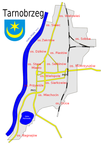
| current | 22:15, 24 January 2010 | | 745 × 1,053 (187 KB) | commons>Atamtari | {{Information |Description={{en|1=Map of town: Tarnobrzeg in Poland - river, roads, railroads and "osiedla" (plural), Osiedle - singular, 2010-01-24 }} {{pl|1=Tarnobrzeg - plan miasta - z drogami i kolejami [[Osiedla Tarnobrzega|osiedl |
File usage
There are no pages that use this file.