File:Point Pleasant Creek map.png
Jump to navigation
Jump to search

Size of this preview: 639 × 600 pixels. Other resolutions: 256 × 240 pixels | 511 × 480 pixels | 818 × 768 pixels | 1,091 × 1,024 pixels | 2,538 × 2,383 pixels.
Original file (2,538 × 2,383 pixels, file size: 5.6 MB, MIME type: image/png)
File history
Click on a date/time to view the file as it appeared at that time.
| Date/Time | Thumbnail | Dimensions | User | Comment | |
|---|---|---|---|---|---|
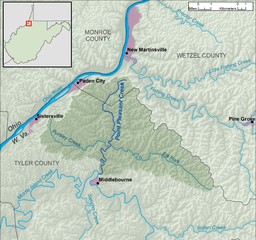
| current | 15:46, 13 December 2013 | | 2,538 × 2,383 (5.6 MB) | commons>TimK MSI | {{Information |Description ={{en|1=A map of Point Pleasant Creek and its watershed (USGS HUC-12 codes 050302010502 and 050302010503), in Tyler and Wetzel counties in West Virginia.}} |... |
File usage
There are no pages that use this file.