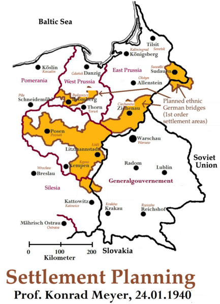
File:Planning Map for Ethnic German Settlement of Warthegau (annexed from Poland).png
Jump to navigation
Jump to search

Size of this preview: 433 × 599 pixels. Other resolutions: 173 × 240 pixels | 347 × 480 pixels | 555 × 768 pixels | 1,040 × 1,438 pixels.
Original file (1,040 × 1,438 pixels, file size: 993 KB, MIME type: image/png)
.png)
File history
Click on a date/time to view the file as it appeared at that time.
| Date/Time | Thumbnail | Dimensions | User | Comment | |
|---|---|---|---|---|---|
| current | 01:47, 2 February 2024 | | 1,040 × 1,438 (993 KB) | commons>Keizers | Cropped |
File usage
There are no pages that use this file.
.png)