File:Plan d’Antsirane datant de 1912.jpg
Jump to navigation
Jump to search

Size of this preview: 465 × 600 pixels. Other resolutions: 186 × 240 pixels | 510 × 658 pixels.
Original file (510 × 658 pixels, file size: 121 KB, MIME type: image/jpeg)
File history
Click on a date/time to view the file as it appeared at that time.
| Date/Time | Thumbnail | Dimensions | User | Comment | |
|---|---|---|---|---|---|
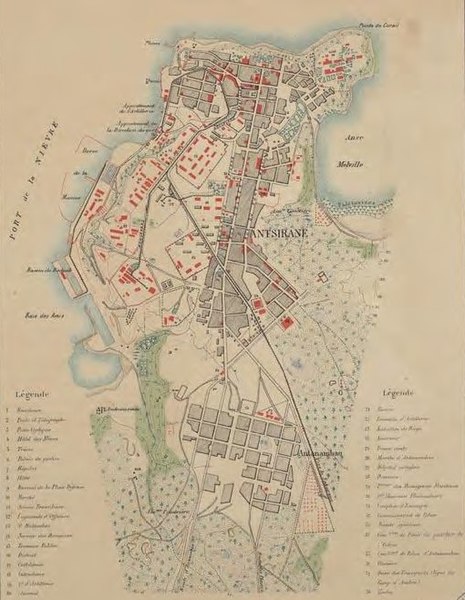
| current | 16:31, 25 February 2019 | | 510 × 658 (121 KB) | commons>NearEMPTiness | =={{int:filedesc}}== {{Information |description={{fr|1=Plan d’Antsirane datant de 1912}} |date=1912 |source=* https://imageo.hypotheses.org/49 * http://geographie.ipt.univ-paris8.fr/rubriks/carto/journalGR/photos/ExpoDiegoAmelot.pdf |author=*Date de publication : 1912 *Auteurs(s) : Carbonnier *Éditeur : Service géographique de Madagascar (Tananarive) *Echelle : 1 / 10 000 *Format : 1 carte en couleur, 47 x 32 cm *Collection : Cartothèque du Département de Géographie, Service Commun de Documen... |
File usage
There are no pages that use this file.