File:Planá nad Lužnicí, Lhota Samoty, common.jpg
From WikiProjectMed
Jump to navigation
Jump to search
Size of this preview: 800 × 523 pixels. Other resolutions: 320 × 209 pixels | 640 × 419 pixels | 1,024 × 670 pixels | 1,280 × 837 pixels | 2,560 × 1,674 pixels | 3,579 × 2,341 pixels.
Original file (3,579 × 2,341 pixels, file size: 1.75 MB, MIME type: image/jpeg)
This file is from a shared repository and may be used by other projects. The description on its file description page there is shown below.
Summary
DescriptionPlaná nad Lužnicí, Lhota Samoty, common.jpg |
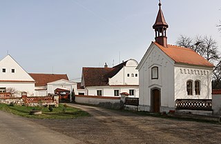
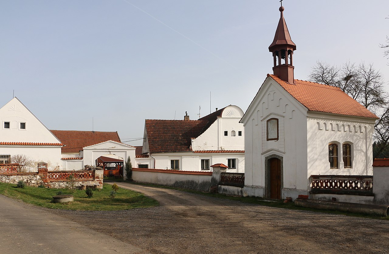
Čeština: Malá náves ve vesnici Lhota Samoty, místní části Plané nad Lužnicí
English: Common in Lhota Samoty, part of Planá nad Lužnicí, Czech Republic. |
||||
Date | |||||
Source |
Own work
|
||||
Author | Pavel Hrdlička (Czech Wikipedia user Packa) | ||||
Permission (Reusing this file) |
Čeština: Tento soubor je uvolněný pod licencí Creative Commons BY-SA. Stručně: Můžete jej použít k jakémukoli účelu, pokud uvedete autora: Pavel Hrdlička, Wikipedie. Výsledné dílo musíte uvolnit také pod touto licencí.
English: This file is available under Creative Commons BY-SA license. Basically: You can use this picture for any purpose, provided that you attribute it to Pavel Hrdlička, Wikipedia. You may distribute the resulting work under the same license.
This file is licensed under the Creative Commons Attribution-Share Alike 4.0 International license. Attribution: Pavel Hrdlička, Wikipedia
|
Camera location | 49° 21′ 36.16″ N, 14° 41′ 01.74″ E | View this and other nearby images on: OpenStreetMap | 49.360045; 14.683818 |
---|
Items portrayed in this file
depicts
4 April 2016
49°21'36.162"N, 14°41'1.745"E
0.004 second
10
18 millimetre
100
image/jpeg
File history
Click on a date/time to view the file as it appeared at that time.
Date/Time | Thumbnail | Dimensions | User | Comment | |
---|---|---|---|---|---|
current | 16:45, 14 May 2016 | 3,579 × 2,341 (1.75 MB) | commons>Packa | VicuñaUploader 1.23 |
File usage
There are no pages that use this file.
Metadata
This file contains additional information, probably added from the digital camera or scanner used to create or digitize it.
If the file has been modified from its original state, some details may not fully reflect the modified file.
Camera manufacturer | Canon |
---|---|
Camera model | Canon EOS 70D |
Exposure time | 1/250 sec (0.004) |
F Number | f/10 |
ISO speed rating | 100 |
Date and time of data generation | 08:55, 4 April 2016 |
Lens focal length | 18 mm |
Latitude | 49° 21′ 36.16″ N |
Longitude | 14° 41′ 1.75″ E |
Altitude | 432 meters above sea level |
Orientation | Normal |
Horizontal resolution | 72 dpi |
Vertical resolution | 72 dpi |
Software used | Adobe Photoshop CS2 Windows |
File change date and time | 21:03, 5 April 2016 |
Y and C positioning | Co-sited |
Exposure Program | Normal program |
Exif version | 2.3 |
Date and time of digitizing | 08:55, 4 April 2016 |
Meaning of each component |
|
APEX shutter speed | 8 |
APEX aperture | 6.625 |
APEX exposure bias | 0 |
Metering mode | Pattern |
Flash | Flash did not fire |
DateTime subseconds | 66 |
DateTimeOriginal subseconds | 66 |
DateTimeDigitized subseconds | 66 |
Supported Flashpix version | 1 |
Color space | sRGB |
Focal plane X resolution | 4,057.8420467186 |
Focal plane Y resolution | 4,060.1001669449 |
Focal plane resolution unit | inches |
Custom image processing | Normal process |
Exposure mode | Auto exposure |
White balance | Auto white balance |
Scene capture type | Standard |
GPS time (atomic clock) | 07:55 |
Satellites used for measurement | 12 |
Receiver status | Measurement in progress |
Measurement mode | 3-dimensional measurement |
Measurement precision | Good (3.6) |
Reference for direction of image | Magnetic direction |
Direction of image | 23 |
Geodetic survey data used | WGS-84 |
GPS date | 4 April 2016 |
GPS tag version | 0.0.3.2 |
Supported Flashpix version | 1 |
Image width | 3,579 px |
Image height | 2,341 px |
Rating (out of 5) | 0 |
Date metadata was last modified | 23:03, 5 April 2016 |
IIM version | 2 |